
I’ve looked up at Devil’s Peak countless times while living in Cape Town. But it was only recently that I actually went up there, to see the place where according to legend, Dutch sailor Van Hunks smoked a fat pipe duel with the devil and created the “tablecloth” cloud that covers the mountain top when the south-easter wind blows.
Early one Saturday morning we started the climb, from the Platteklip path entrance towards the end of the Table Mountain cableway road. The sky was still cloudy and fading orange, the sunrise having been a ripple effect of rose-pink. The path up was mildly steep, but passing a few veteran hikers on the way down, I was assured that this wouldn’t be a backbreaking climb. But I still felt the burn of the steep incline on my quads, and the increase in heart rate after each series of elevated steps.
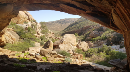
We followed the Platteklip path upwards until we were instructed to turn left by one of the Table Mountain National Park silver signs, and then continued up towards the peak. Passing through rock overhangs and into fynbos shrub, we had a panoramic view of the City Bowl, the tightly packed houses and flats below becoming smaller as we ascended.
There was a big group ahead of us, so climbing was a bit slower, but it gave me the chance to photograph the view, avoid the scratchy “hiker’s friend” bushes and attempt a few shots at the rescue helicopter to our right that was presumably doing a practice run, trying to save a yellow dummy from the side of the ridge as we pushed towards the beacon.
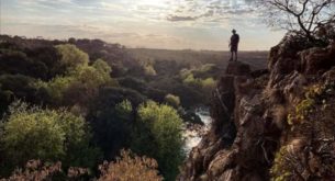
When we finally made it to the top, after mistakenly thinking we were done after reaching the first beacon, the wind had picked up so we found shelter underneath the beacon between the lichen splotched rock folds. From here we could see Table Bay and False Bay, and all the landmark buildings, houses, forests, mountains and university buildings in between.
And the extremely narrow looking knife-edge path leading up to the peak from the Rhodes Memorial/King’s Blockhouse side- a route we were glad not to have taken as we hesitantly peeked into the deep chasm below us.
After cooking up some Glen tea in the handy “Fokr” gas stove, a hand me down from my grandparents, we took turns looking through my cousin Chris’ stamp microscope at the greenish-grey lichen on the rocks around us. I couldn’t see through my eyelashes, but it was the first time I’d actually even tried to see lichen that close before, so it was an interesting novelty.
We also felt the fluffiness of the “skaap ore” or sheep’s ear plants next to us, the white leaf fur almost like soft matted spiderweb. While taking another break on the way down, I also saw the most interesting Art Deco reminiscent geometric-leafed bush, with dark pink blossoms, a wild flower I’d love to know the name of.
The same path down became a bit choked up with the group of thirty making their way down, so we decided to take the alternative route to our car via to the closed-off cableway contour road, via Oppelskop. It took a lot longer than we expected, but it gave us the chance to appreciate another panorama of the city, and see frogs and fish in the manmade pools at the side of the road, built to catch the natural stream run-off.
As the road has been closed off for a while, the grass has grown in square patterns in gaps along the tarmac. Gum trees line the path, as well as invasive wattle trees, which are systematically being taken out by nature conservation- visible by blue painted, poisoned stumps.
On our return to the car, the cableway road was busier, with a lively influx of visitors to the cableway and surrounds. A church service/celebration was taking place in the clearing between the shrubs below us, and a very intensely focused musician blew a very catchy flute tune on his melodica. It was a tune I couldn’t get out of my head while driving home that day, but now have to remind my cousin to whistle whenever I see him. And then we laugh.
How to get there:
Drive up Kloofnek Road towards Camps Bay and take the Cableway turnoff left. Continue along the road, past the Table Mountain cableway station, until you see a parking lot next to one of the Platteklip signs, where the trail begins. Alternatively, there is another entrance to the Devil’s Peak path further along the closed-off end of the cableway road, past the information hut.