

No trip to Zimbabwe is complete without a trip to Lake Kariba (should it be called Dam Kariba, as it’s a man-made body of water?).
So after Imbabala, I headed back east again, through Vic Falls, and onto Binga on the western part of Lake Kariba. Brett McDonald from travel operator Flame of Africa had invited me to see his houseboat, called Lady Jacqueline (after his wife Jackie!).
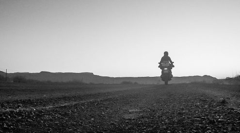
The drive from Vic Falls to Binga takes you south towards Hwange, then east to Kamativi, then north again to the shores of the amazing Lake Kariba. It’s a long drive – with lots of potholes, so don’t rush it…you need to be careful.
As soon as you leave the main road between Bulawayo and Vic Falls, you hardly see any cars or trucks. Communities are noticeably poorer, and the presence of US AID Toyota Hiluxes and other international NGO outfits confirms it.
The Binga area is home to many of the Batonka people that were forced to leave their ancestral homes when Lake Kariba was completed in 1958. The Batonka used to live alongside the old course of the Zambezi River, but when the river started rising because of the dam wall, about 20 000 Batonka were taken away to other areas. Binga is the main town where many of them were relocated in Zimbabwe (the rest were moved to the Zambian side). There’s apparently still some bitterness about it, understandably so. Besides losing their traditional land, there was a widespread outbreak of dysentery in the resettled community, which killed 81 people.
Initially, the Batonka didn’t believe that anything could stop the flow of such a mighty river…and they predicted disaster for the white man’s dam wall. The deity of the their river – Nyaminami – was believed to be angry about the attempt to stop the flow, and sure enough, in 1957 and in 1958, two massive floods (the largest in recorded history) descended the Zambezi – almost destroying the work-in-progress of the dam wall. Coincidence?
The maximum depth of the dam is about 100 metres, with the average depth being about 29 metres. So tall trees were a problem, especially for boats who were going to use the dam for fishing, as well as houseboats. Authorities had to clear the tall trees from 250 000 acres at 6 harbour sites before the waters started rising. Some trees were cut off at the trunk and burnt down to ash, but huge steel balls were also used, dragged by bulldozers with massive chains…and they certainly did their job, as you can see from the photos.
Vast numbers of trees still stand in the shallows of Kariba’s shores. These are mostly mopane and I believe that they play a massively important role in the ecology of the waters of the dam. Apparently, the surface area of all the submerged trees in Kariba is more than the entire surface area of the bottom of the lake, and as such harbour much of the tiny organisms which contribute to the food chain.
In addition, the submerged and partly-submerged mopane trees have a very hard wood, which has been made even harder by the absorption into the wood of the silica in the soil and water…so that instead of rotting, the trees have actually become harder, even though they are dead.