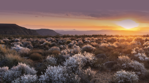

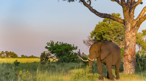
Meander off the beaten track, way beyond the town of Mooi River, and you’ll soon bliss out on the beauty enveloping timeless villages such as Nottingham Road and Rosetta. Continue along the gravel roads winding past these dorps and you’ll lose yourself within Kamberg, one of KwaZulu-Natal’s premier nature reserves.
The ride in Kamberg
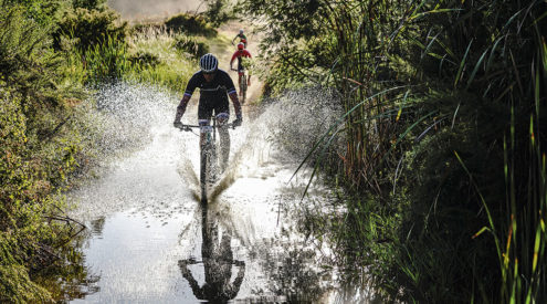
One thing’s for sure, you won’t get lost on a Kamberg crank. It’s one of the easier mountain-biking routes to navigate, so there’s no need to worry if you don’t pack a GPS or compass. Kick off from Kamberg Camp, rolling downhill from the cottages along a cement dual track descending towards the trout dams for 900 metres.
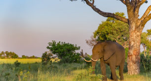
Turn left onto a very short section of tarmac and onto the jeep track (1,2 kilometres), ignoring the no-entry sign as this is aimed at vehicles only. A gritty little climb through a drift and into the grassy foothills will get the blood pumping, but you’ll have ample time to look around for eland and other plains game.
At the 3,9-kilometre mark, you can either keep left past the giant tree ferns to the old Roman baths ruins, but this track soon peters out.
Rather stick to the right, heading onto a juddery dual track, dipping and climbing amid the grassland ridges. Expect a few steep climbs and descents, as well as a stream crossing or two, so watch your step.
By now, you’ll be zipping along tight dual track descending steeply towards the Mooi River way below (6,6 kilometres). Keep your weight back on this downhill section to avoid going over the bars on some of the stony drop-offs, then chill out at the riverside before heading back to camp.
Off the bike in Kamberg
Kamberg is famous for two things, fly-fishing for wily trout in stocked dams or along the Mooi River and fascinating rock art. If you check out the latter, tramp onto the Gladstone’s Nose hike from the camp, arguably one of the more scenic hikes in KwaZulu-Natal.
Need to know about Kamberg
Summer thunderstorms strafe these valleys, so keep a careful eye on the weather to ensure you’re not caught. Uncontrolled mountain fires and rogue baboon raids on chalets are other potential dangers to be aware of.
Getting to Kamberg
Take the Mooi River off-ramp from the N3 and look out for the turn-off to Rosetta to your right. Kamberg Nature Reserve is clearly signposted from here, and you can expect the 41 kilometre drive from Rosetta to take in the region of an hour.
Gear for Kamberg
Maximise your enjoyment by saddling up the new Slider 275 Mountain Bike (from R21 500, www.silverbacklab.com). The 27,5-inch wheel fits in between standard 26-inch and full-size 29-inch options. Designers pitch it at riders keen on maintaining a combination of good manoeuvrability and effortless climbing.
Kamberg route facts
Grading: Moderate
Duration: One to one-and- a-half hours
Configeration: 13,2-kilometre return route
Start point: Kamberg Camp
Terrain: Dirt road and dual track
Entry requirements: Day permits required (R30)
Cell reception: Good coverage
GPS co-ordinates: S29º 23’ 13.54”, E29º 40’ 4.82”
Kamberg contact details
Tel 033-845-1000, www.kznwildlife.com.
Mountain-biking trails in South Africa
For detailed information on mountain-biking trails across South Africa, go to www.mtbroutes.co.za.