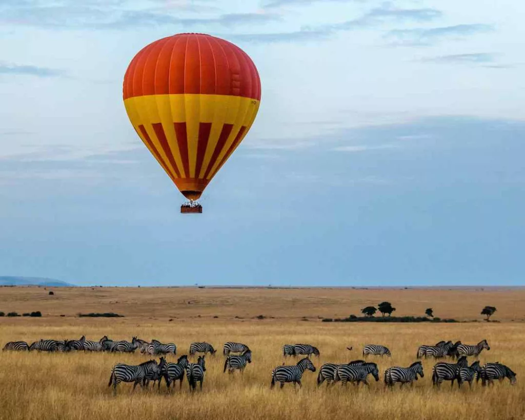


The Drakensberg and Kilimanjaro will forever enjoy recognition as being some of the world’s best hiking locations, but they are not all the African hiking trails on offer. Whether it’s central, Southern, North, East or West Africa, our continent has trails that boots should be itching to cover.
ALSO READ: Top hiking trails around Pretoria
1. Rwenzori Mountains, Uganda
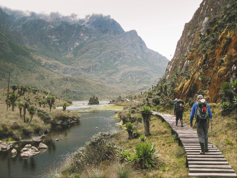
Known as the ‘Mountains of the Moon’ because of their snow-capped peaks, this legendary mountain range was believed by Ancient Greek geographers to be the source of the Nile. The Rwenzori Mountains are on the border of Uganda and the Democratic Republic of the Congo (DRC). Rwenzori means ‘rain maker’ in the language of the Banyarwenzururu who live on the lower slopes of the mountain.
The Central Circuit Trail is a striking, well-maintained route that takes seven to nine days and there are plenty of huts along the way. The highest peak belongs to Mount Stanley (5109 metres) which takes a week to reach and climb. The Rwenzori Mountains are not without animals but spotting them is rare. The giant forest hog, leopard, buffalo, hyrax and bushbuck dwell within the mountains and primates such as the black and white colobus, blue monkey, and chimpanzee can be found. There are also more than 200 bird species, 19 of which are endemic.
The glaciers of the Rwenzori Mountains have also helped it earn the ‘African Alps’ as its nickname. Unfortunately, climate change has resulted in the retreat of these glaciers, but has also led to the formation of a number of lakes which you may come across on the trails.
ALSO READ: 10 amazing places to go trekking in Namibia
Read: Walking on the moon: Climbing the Rwenzoris
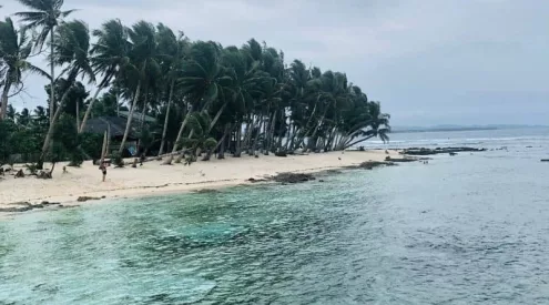
2. Chamarel Waterfall and Seven Coloured Earths, Mauritius
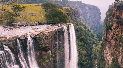
The rainbow isn’t nature’s only multi-coloured phenomenon. A hike through lush tropical forest in south-western Mauritius culminates in a view of the Seven Coloured Earths of Chamarel, a geological spectacle that has fascinated tourists since the 1960s. These are sand dunes where seven prominent colours – red, brown, violet, green, blue, purple and yellow – are noticeable, especially at sunrise. These colours are caused by the conversion of basaltic lava into clay minerals. The Chamarel hike is approximately six hours and you will come across Piton du Canot mountain which you may decide to climb (it takes around 45 minutes). Nearby is the Chamarel Waterfall that is over 80 metres high. You will also pass the Black River Peak which is Mauritius’s highest mountain. There are several routes to the summit and they range from 3.5 kilometres to 5.5 kilometres. The Black River Gorges National Park is a protected forest that is also plentiful in trails, and it can be entered via the Black River entrance.

Photo by Martin Falbisoner
3. Mount Cameroon, Cameroon
Picture: jbdodane/Flickr Commons
At over 4000 metres, Mount Cameroon is one of Africa’s most active volcanoes, erupting every 10 to 20 years. It is also the highest mountain in West Africa. It is usually ascended using the Guinness Route (two days), which is a direct, albeit steep path to the summit starting from Buea. The most popular guided tours are the three or four-day options but there are tours for just one or five days. There a numerous peaks and craters and the terrain also varies from farmland and rainforest to savannah. Mount Cameroon is rich in biodiversity with endemic plants and birds.
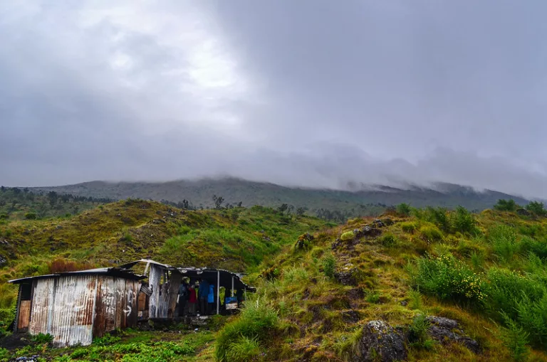
4. Mount Meru and Pugu Hills, Tanzania
Mount Meru (4565 metres) might draw fewer crowds than Kilimanjaro, but Tanzania’s second-highest peak (in Arusha National Park) is apparently more challenging to climb. The summit can only be reached via the Momella Route but the lower slopes are teeming with wildlife such as buffalo, elephants and giraffes. It is therefore advisable to be accompanied by an armed ranger. The ascent consists of following the north rim of the volcano’s crater where there are scenic views. The forests and lakes make for great picnic spaces. Mount Meru is good acclimatisation for Kilimanjaro. A Mount Meru hike through Tanzania Expeditions is two nights and three days.
About 20 kilometres from Dar es Salaam is an area containing some of the world’s oldest surviving forests. Pugu Hills is home to the Kazimzubwi and Pugu Forest Reserves which are excellent for hiking and biking. There are over 80 recorded bird species making Pugu Hills the top forest for conservation. As a protected area, the forests are a habitat for civets, bush babies and leopards. There is also a viewpoint with a panoramic scene of Dar es Salaam. A walking tour of Pugu Hills is about four hours.

Mount Meru escapes its cloudy covering to tower over Ngurduto Lodge. Photo by David Youldon
5. Mount Mulanje, Malawi
Malawi’s Mount Mulanje or Mulanje Massif is located in the country’s southern region and is wonderful for hiking and climbing enthusiasts and also accommodates those looking for a gentle stroll. There are deep forest ravines, plateaus, waterfalls and peaks that are waiting to be explored. Trout fishing can also be done in River Lichenya. There are 18 hiking routes ranging from short walks to multi-day hikes. A comprehensive hiking guide has been created by the Mountain Club of Mulanje.
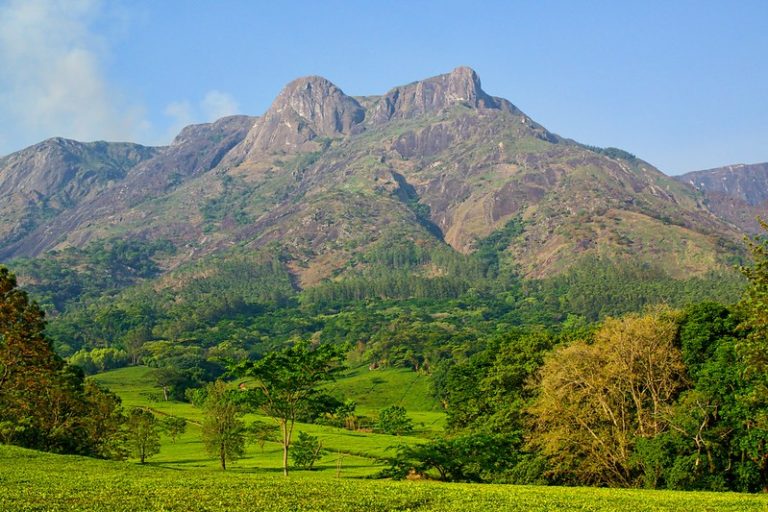
Mount Mulanje is a biodiversity hotspot
6. Monte Alen National Park and Pico Basile, Equatorial Guinea
Described as Equatorial Guinea’s best-kept secret, Monte Alen National Park possesses well-maintained and accessible trails surrounded by 1400 square kilometres of virgin forest where you can find forest elephants, West African lowland gorilla, chimpanzees, mountain gorillas and crocodiles. Gorilla trekking is a tourist attraction in the area and locals are usually hired as guides for the trekking activities. You can trek, hike or walk in Monte Alen National Park but frequent wet and slippery conditions require waterproof hiking gear. It is also quite gruelling and you can hike for 22 kilometres per day. Permits from government offices need to be obtained before entering the park.
Pico Basile on Bioko island is a shield volcano that is 3000 metres above sea level. It has a gravel road that one can drive or walk on and on a clear day Mount Cameroon can be seen. There are guided tours of Pico Basile but they don’t go to the summit. Instead, you stop at the Virgin of Bisila, a historical monument at 2800 metres.
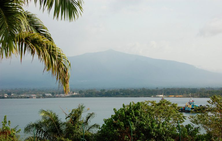
Photo by John and Mel Kots
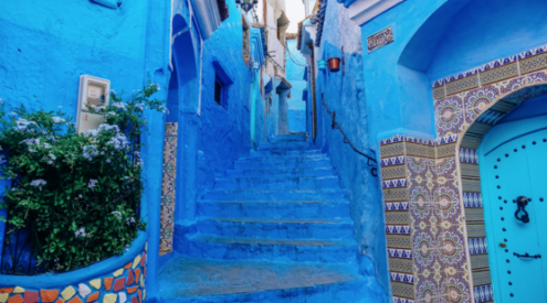
7. Rif Mountains, Morocco
Overlooking the Mediterranean Sea are the Rif Mountains in northeastern Morocco which have expansive, open trails and cedar forests that offer a deep look into the Moroccan countryside. The trails are considered to be ‘off-the-beaten track’ and the best place to start is Chefchaouen, also known as the Blue Pearl of Morocco because of its old blue buildings. The Chefchaouen to Fifi Aghram trail is two days with up to five hours of walking on each day. A local eco-tourism company also organises a 10-day hike from the Rif Mountains to the Mediterranean coast, a 7-day trek through Talassemtane Natural Park where you can see God’s Bridge (natural arch and river) and Akchour Waterfall.
Picture: Steven dosRemedios/ Flickr Commons
8. Dogon Country, Mali
The Bandiagara Escarpment/Cliff of Bandiagara is a UNESCO World Heritage Site in Dogon Country, Mali. The cliff features the famous architecture of the Tellem who originally lived on the escarpment and carved their homes into the sandstone cliff-face. The Dogon arrived later on in the fifteenth century and they live there presently. The Bandiagara Escarpment is 500 metres high and stretches for 150 kilometres. Treks can last from one day to several weeks and you can also stop by the Village of Songo for a cultural experience.

Photo by Ferdinand Reus
9. Malolotja Nature Reserve, Swaziland
The Swaziland reserve is located on a sprawling 18000 hectares of mountain wilderness composed of protected highveld grassland, mist belt forest, wetland and woodland. Ngwenya Mountain is Swaziland’s second highest mountain and sits in Malolotja; the Nkomati River Valley is also in the reserve as well as Malolotja Falls, the highest waterfall in Swaziland. Malolotja is popular for its wildflowers such as the Barberton and Kaapsehoop cycads which are under threat. There are over 200km of hiking trails at Malolotja where one can choose between short walks and overnight trails. Campsites along the routes can help with planning and a seven-day trail that covers most of the park is recommended.

Sunset over Malolotja Nature Reserve. Photo by Tyson Jopson/ Getaway Gallery
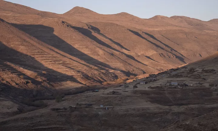
10. Bokong Nature Reserve, Lesotho
Take a trip to the highest nature reserve in Africa (3000 metres above sea level) situated in the Lesotho Highlands. There are interconnected hiking trails and walks in the Bokong Nature Reserve and a route leading to Katse Dam which has the highest dam wall in Africa. In Bokong, there is a 45-minute interpretive trail, half and full-day walks and a two to three-day 40km hike along the ‘Roof of Africa’ that goes to Ts’ehlanyane National Park, the largest in Lesotho. Bokong is made up of grasslands, heathlands and wetlands and the surrounds of the Maloti Mountains make for an exhilarating adventure. There is also the unmissable Lepaqoa Waterfall (60 metres) which freezes in winter and is a treat for the eyes.
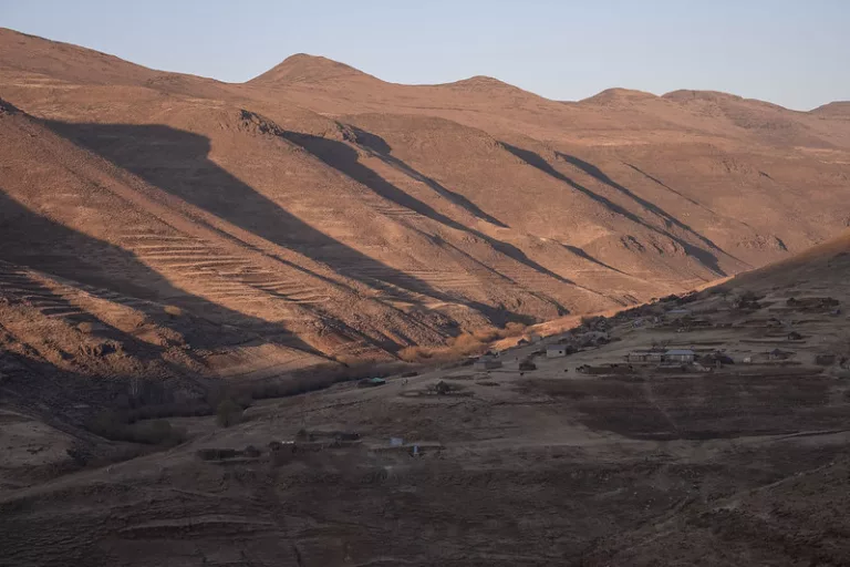
The Lesotho highlands. Picture: Boundless Southern Africa/ Flickr Commons
Follow us on social media for more travel news, inspiration, and guides. You can also tag us to be featured.
TikTok | Instagram | Facebook | Twitter
ALSO READ: Budget Lesotho: a snowy 4X4 adventure