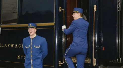


She’s as old as time and recognised the world over. To Capetonians she’s part of the cityscape, a familiar backdrop. Yet delve a little deeper and Table Mountain stirs up new stories, a veritable did-you-know of facts, footpaths, fascinating history and flora that may surprise even locals.
Words & photos Catherine Hofmeyr

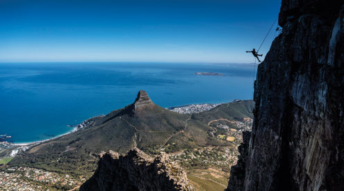
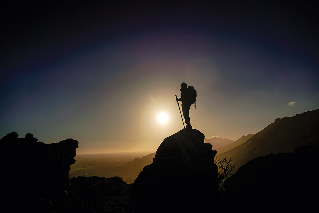
Strike a ‘hands-free, Hullo Mama’ pose on a 112m abseil off the top of one of the Seven Wonders of Nature. Take a friend along for the high as Abseil Africa have a two-for-one special offer running.
Hiking
Trails less tramped
You could probably walk a different trail on Table Mountain every day of the year, if you chose to. You won’t be disappointed in these lesser-known routes on the back Table around Hout Bay.
On the Cave Peak section above Kalk Bay.
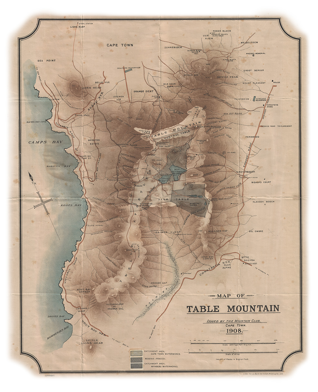
Orange Kloof
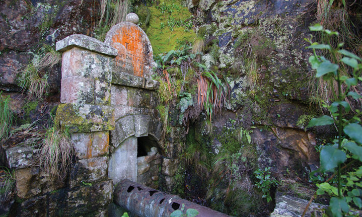
The horseshoe-shaped valley, filled with afro-montane forest, moss-lined streams, waterfalls and pristine fynbos remains the hidden gem of the back table – mostly because access is restricted. Getaway joined mountain guide Frank Dwyer for a hike from Constantia Nek. Hout Bay views receded and South Peninsula sights unfolded as we branched off the jeep track to follow a path up into the Disa River Gorge. This route eventually leads to Woodhead Dam atop Table Mountain, and is part of the original Hoerikwaggo Trail (not currently in operation). Our destination, however, was a more furtive one – the ‘secret’ tunnels.
Woodhead Tunnel was built to convey water from Disa River and Woodhead Dam through the Twelve Apostles to the pipetrack above Camps Bay (see History below). It was eventually replaced by the more modern Apostle Tunnel a bit higher up. The 640-metre Woodhead Tunnel is still there – but don’t be tempted to climb in for a shortcut to Camps Bay, it’s sealed at the other end! Our return route took us via the streamside ramble that leads up to Hell’s Gate waterfall – another lovely route in Orange Kloof.
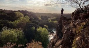
Atop Suther Peak’s 614m summit.
You need a registered mountain guide or Mountain Club member to get a permit. Contact Frank Dwyer of Platteklip Tours & Trails- enquire about the fully catered Orange Kloof hike to stay over in the Overseer’s Cottage on top. Guided hikes from R250 pp. 082 882 4388, plattekliptours.co.za
Duration: 5-6 hours for the tunnel route
Fitness: Moderate
Making fine use of a prize
About five years ago, registered guide and Hangberg resident Brent Thomas and associate Collin Delcarme won a competition for ‘Seeing Hout Bay through the eyes of a local’. The R50 000 prize money enabled them to start Karbonkelberg Tourism. It’s a community initiative that trains guides, gets kids into nature, and offers hiking, mountain-biking and culinary tours in the area. ‘Our mountain has a reputation for being a high crime area but we’re from the local community and we guarantee your safety,’ Brent said. ‘It’s a case wolf of skaapwagter maak,’ he added with a grin. Guided hikes from R150 pp. 084 099 6601, karbonkelbergtourism.co.za
Karbonkelberg
The Karbonkelberg massif rises up behind Hout Bay Harbour and comprises several peaks, all well worth a ramble. Due to muggings in the past, it’s best to hike with a local guide (see box p77). The great guys from Karbonkelberg Tourism offer several routes including to Seal Island, full moon hikes up Sentinel, and longer routes to Fort Collins, the Boss 400 wreck and Suther Peak.

Sentinel I joined Brent and his fellow ‘Rasta’ guides on the full moon expedition. What a great community vibe and new initiative this is, with up to 50 locals joining in when the weather is fine. Our going was slow as plant man Johannes October gave us the run-down on medicinal uses of shrubs we passed. We blew up ‘Smugglers Path’ to the saddle overlooking Seal Island and famed big-wave spot, Dungeons. Then a steep pull took us up to the very summit of the peak that guards Hout Bay. Plummet off this precarious rock and you’re in the sea 331 metres below (base jumpers have been known to take off here – but don’t tell anybody).
Duration 2-3 hours, sundowners on top
Fitness Moderate
Mishak Thomas nearly loses his braids to a howling southeaster on Sentinel.
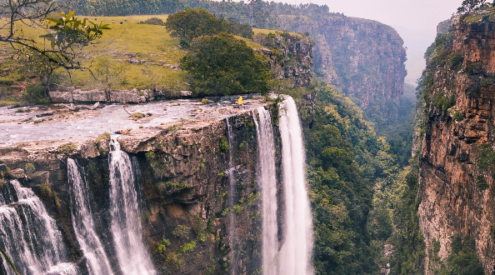
Suther Peak ‘How could anyone contemplate emigrating when you’ve got this on your doorstep’ asked a fellow hiker as we stood, taking in the 360-degree view from atop Suther Peak on a pearl of a Sunday morning. He had a fine point. The sea off Sandy Bay was Seychellean turquoise, each blade of kelp defined in the startling visibility. From Sandy Bay beach, Suther resembles a crumbling, crenellated watchtower on the skyline of Karbonkelberg; on top it’s a precarious but sublime perch for morning tea. You can hike it either via a gentle but longer walk from Hout Bay, or a steeper ascent with some tricky rock scrambles from the Sandy Bay dune neck. Best still, do the roundtrip. This one’s right up there in my top three Peninsular hikes.
Duration 5-6 hours, gives time for tea
Fitness Strenuous, with some rock scrambling

Handholds and chains assist in the scramble up Suther Peak.
Caving
Get under the mountain’s skin
Whether it’s the get-down-on-your-belly-and-crawl-in type or the large-hole-in-the-side-of-the mountain variety, Table Mountain offers something for everyone
Words: Alan Valkenberg
Elephant’s Eye
The mountain it’s found on looks a bit like an elephant’s head and the cave is – you guessed it – right where the eye would be. The cave’s a great viewing spot over the Southern Suburbs through to the coast and the walk from Silvermine Nature Reserve is do-able for the whole family; hikers who want a longer challenge can tackle it from the Tokai Arboretum. The cave itself has a high ceiling and offers respite from the sun as there’s not a lot of shade on the way. Legend has it the cave used to belong to a powerful Hottentot chieftain.

Woodstock Cave
One of the largest visible caves on Table Mountain, Woodstock Cave is basically a long horizontal crack 50m wide by 15m deep, halfway up Devil’s Peak. The cave offers fantastic views of the city, Lions Head and Table Bay and is a popular picnic spot after a walk on the mountain. It’s easily accessible from either Rhodes Memorial or Tafelberg Road.
Boomslang
As Muizenberg Beach around the corner is for surfers, so Kalk Bay caves are for cavers – both offer novices the chance to learn the craft in a not-too-threatening environment. Boomslang is a proper cave system, tunnelling through the mountain from Echo Valley above Kalk Bay to the Clovelly side. Explorers will need a torch and someone who knows where they’re going. Some sections need crawling and are damp so if either of those things – or the thought of bats – put you off, give this one a skip. Start your hike at the Echo Valley climb on the Kalk Bay side of Boyes Drive.

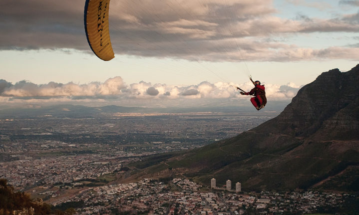
Gentle updrafts make for excellent paragliding over the City Bowl and Atlantic seaboard. With a 100% safely record over 24 years for tandem flights, you’re in safe hands.
Manganese Mines, Hout Bay
The quickest way to reach these mines is via Chapman’s Peak Drive, near East Fort. There are several mine shafts and some have dangerous drops so don’t explore without someone who knows what they’re doing. No 7 shaft has the largest entrance – 15m wide and 3m high – but only stretches 20m deep. However, if you’re looking for a thrill, No 4 shaft travels 84m into the mountain and you’ll need a torch to explore its secrets. East Fort is a potential crime area so you should take a guide here. Contact Brent Thomas of Karbonkelberg Tourism, 084 099 6601.
Wynberg Caves
This fascinating cave forms part of a much larger system, formed along a fault line in the sandstone, with about 5km of tunnel length. The cave itself is 1km long, with a depth of approximately 50 metres from the ground surface at the deepest point. There are passages and tunnels veering off at different levels, in different directions, and it’s easy to lose your way. The cave is home to a variety of fauna and flora, including a species of Cape bat and white peripatus (velvet worm), endemic to the Western Cape. It’s about a two-hours hike from Constantia Nek to the cave system on the Back Table. This cave system is not recommended without a guide.
For guided caving trips, contact Cape Peninsula Speleological Society (CPSS) on 082 955 4426, [email protected].

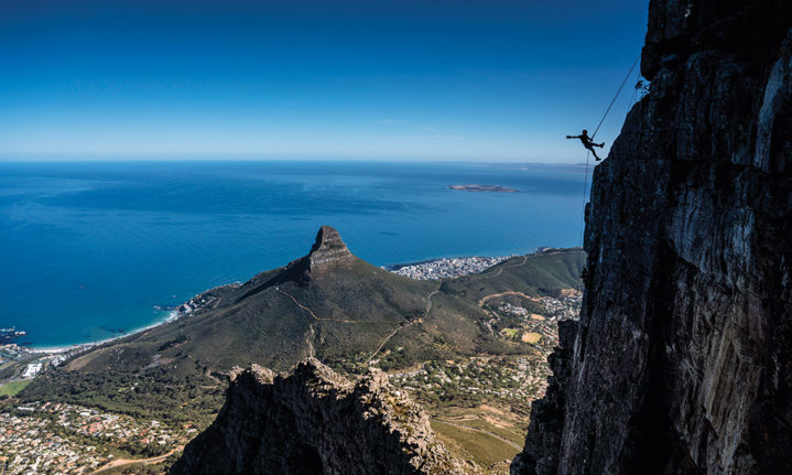
Table Mountain’s legendary climbing routes are graded from nine to 32, and cater for most abilities.
Adventure
Do it if you dare
Where there are lofty heights there are thrills to be had, and Table Mountain is no slouch in this department.
Abseil
Adventure operator Abseil Africa has been enabling the brave to step off the Table Top into thin air for many years. Actually, it’s a controlled 112m descent but walking backwards off vertical Fountain Ledge is pretty white-knuckle stuff. Think of abseiling as ‘dope on a rope,’ says company founder (and general adrenaline junkie), Trevor Ball. Jump at the lekka local special currently on – R500 for an abseil for two people. 072 065 1520, abseilafrica.co.za
Tandem paragliding
Several registered companies offer tandem paraglide flights from Lion’s Head and Signal Hill. No experience is necessary. After a safety briefing all you, the passenger, need do is jump – and then enjoy the unfolding views as you drift over Camps Bay and Clifton. Look out for specials from R950, but expect to pay from R1 250 pp. Contact hi5paragliding.co.za; tandemflight.co.za or adrenaline-hunter.com

Trail runner Lauren Granger is in her happy place descending Suther Peak at sunrise during one of the trail-challenges. (Photo Barbara Cole)
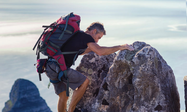
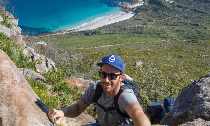
Rock climbing
Table Mountain proper offers around 200 multi-pitch routes on the excellent quality sandstone rock. The two main climbing areas are the 80-metre-high cliffs below the top cable car station, starting from the north facing Africa Ledge, or Fountain Ledge which faces west over Camps Bay. Climbing ZA offers full or half-day guided climbing or beginner trips with all equipment supplied, from R2 000 pp. 082 696 4067, climbing.co.za
Accept the challenge
For trail runners, the Table Mountain chain is a natural wonder on their doorstep, and the mother plays host to several gruelling annual events, including a 100km Ultratrail (ultratrailcapetown.com)
Table Mountain Challenge (TMC) in November is a 44km circumnavigation (or 22km lite route) of the mountain, starting and ending in the city. Entries from R250, tablemountainchallenge.co.za
The Beast takes place from the Newlands side of the mountain in mid-winter and promises 50km (there’s a 30km route, too) along the toughest trails. Entries from R250 pp, beasttrailrun.co.za
Flora and Fauna
This could get orchid
No single book, nor single mind, can encompass all the flowers of Table Mountain. The subject is just too vast, the diversity too rich. Approximately 1 400 flowering species call Table Mountain home, and none is more sought-after than the ephemeral red disa.
Words: Matthew Sterne

Disas often appear in clusters, such as in Myburgh’s Waterfall Ravine in Hout Bay.
Come January, in the dark, damp crevices around Table Mountain, disa uniflora blooms, glistening like a ruby in a cave. It’s one of the largest orchids – yes, orchids – in the world and more beautiful in person than photos. German botanist Rudolph Marloth said the gorgeous colouring can only be fully appreciated ‘when seeing the blooms on a cliff, just touched by the early sun, or on the banks of a murmuring brook whose clear waters reflect their glory’. Delicate, mystical and iconic, ‘The Pride of Table Mountain’ is the emblem of the Mountain Club of South Africa as well as all Western Province sports teams.
‘The last two years people have gone dilly about them,’ hiking guide Tim Lundy says. ‘They’re fascinated by the detail in the flower and because they only bloom for a couple of weeks a year in certain spots.’ Turns out, it’s just one of 80 orchids that appear on Table Mountain. But, as the majority of Cape orchids are fire-dependent and many remain dormant for long periods, some spectacular species are only rarely seen flowering.
The red disa-appears in clusters where there’s moss and shade, often near waterfalls or streams such as Myburgh’s Waterfall Ravine, the top of Window Gorge and the aqueduct on Table Mountain. ‘Red is an unusual colour for a flower because not many insects can see it,’ botanist Dr David Gwynne-Evans explains. ‘Instead, it’s pollinated by the aeropetes tulbaghia butterfly, commonly known as the Table Mountain beauty or mountain pride, which is a remarkably specialised relationship.’
Other disas found on Table Mountain include the drip, common green, red, golden, yellow and granny’s bonnet disas. The blue disa grows all over the top of the mountain, also appearing around February. Look out for them just off the path near the top of the cableway.
Disa-spotting Tim Lundy offers guided disa quests in January and February for R350 pp. [email protected] or join his hiking group on Facebook – Cape Town hiking with Tim Lundy.
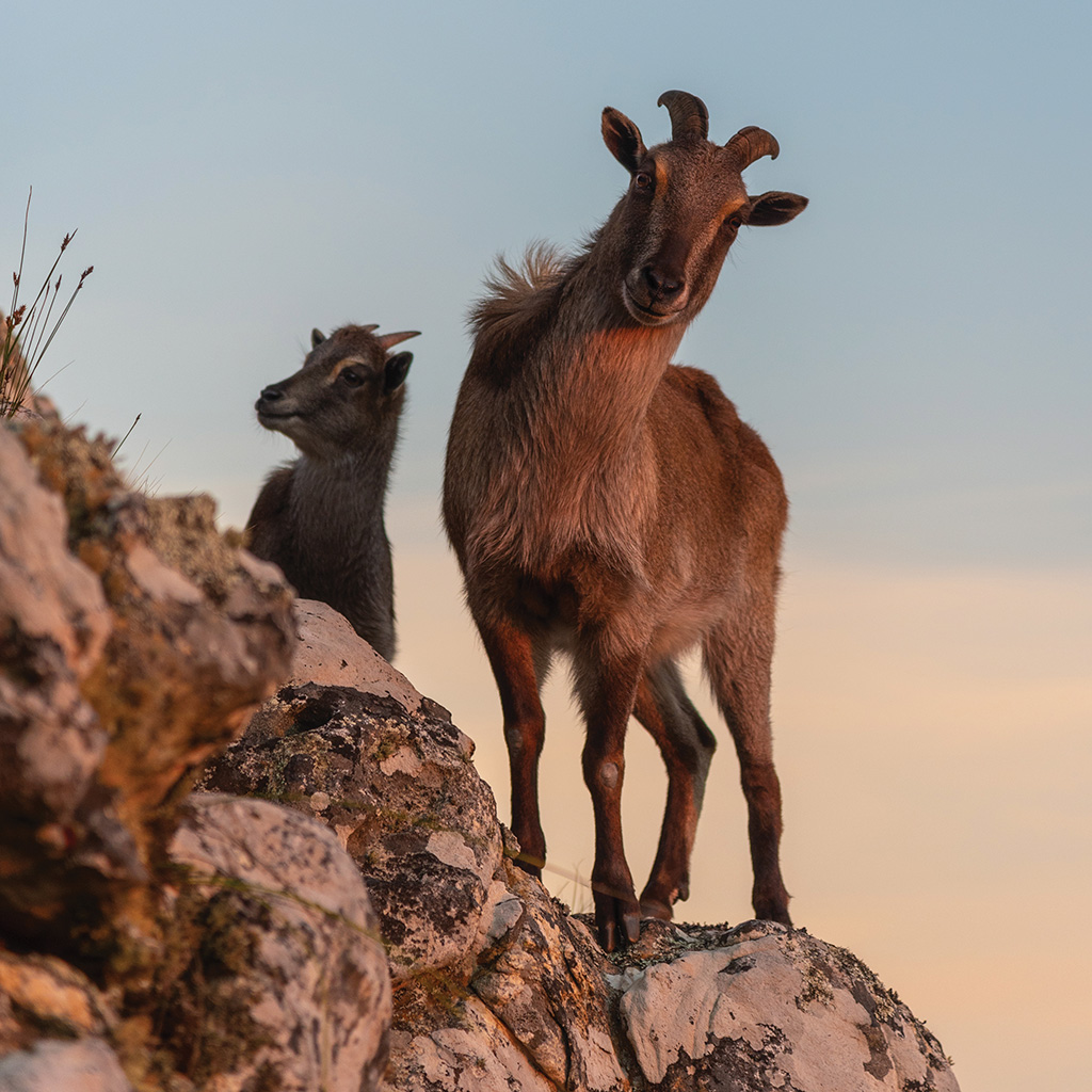
The 1.5-metre-high fence at the Groote Schuur Zoo was not much of a challenge for these mountain dwellers.
A royal bloom
The genus Disa is said to be named after the legendary Queen Disa, from a famous Swedish saga of the Middle Ages. The dorsal sepal of some disas have a net-like appearance
reminiscent of the fishnet in which heroine Disa appears before King Freyhr, outsmarting him to save the elderly, sickly and handicapped from a culling.
It’s wild – but not like it used to be
You needn’t fear ‘being devoured by lions, bears, tigers and other wild beasts of which many dwell in these valleys and crags,’ as the first men to sleep on Table Mountain reported in 1679. But a light tread may reveal some elusive species.
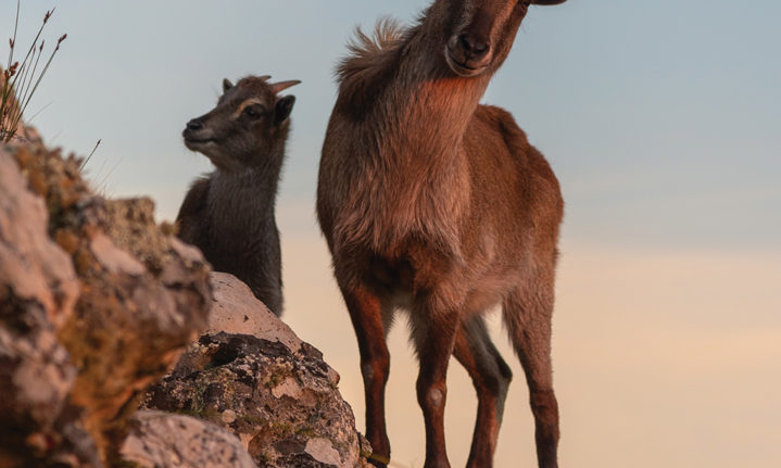
Himalayan tahrs were imported to our shores in the early 1900s. Two of them escaped the Groote Schuur Zoo and bounded up the rocky mountain not unlike their natural habitat. Decades later, the descendants of those shaggy escapees have adapted to the vegetation and terrain, creating a fair-sized colony. The lack of snow leopards is particularly convenient for them. The only real obstacle is the occasional culling programme carried out by authorities due to the erosion and other environmental issues they cause. They’re rarely seen anywhere but on the more remote parts of the mountain.

Experts estimate there to be roughly 50 caracals at any given time in TMNP.
Photos and videos on social media of caracals on Table Mountain are mostly due to The Urban Caracal Project, started in 2014 by Dr Laurel Serieys to study the Peninsula’s population. ‘We ended up capturing more caracals than anticipated, 26 in total, but we likely sampled only half of the population,’ says Laurel. ‘It’s very difficult to know the exact numbers as caracals are very cryptic, rarely seen animals that don’t have unique identifying markings.’ That’s where sightings from the community have become so important to the project. To find out more, go to The Urban Caracal Project on Facebook.
The Table Mountain ghost frog is a rare and elusive species only found on and around our flat-topped wonder. The common name, ghost frog, originates from where the genus was first recorded, Skeleton Gorge, a steep and, to some, ghostly ravine.
There’s a fire on the mountain
In precolonial times, fires started mainly through lightning and patch burning by Khoi-khoi herders. In 1495, Vasco da Gama noticed this too, naming the South African coastline Terra de Fume because of the smoke he saw from numerous fires.
History
How time flows
Water has not only shaped the slopes of Table Mountain, it’s dictated the course of this entire city.
Words: Anton Crone
A vast number of streams and springs flow from this enormous mountain. They provided local inhabitants and wildlife with sustenance for eons, then the 1652 arrival of Dutch colonists marked the beginning of rapid change. It began with the erection of a fort at a river mouth flowing from what is now known as Platteklip Gorge. Named the Varsche Rivier, it was from here that a growing number of passing ships took on fresh water. If you hike up Platteklip you are scaling the source of the very thing that set Cape Town’s transformation in motion.
In 1660, the Dutch East India company installed irrigation furrows to sustain the Company’s Gardens where produce was grown to replenish ships, and canals or grachts soon followed (from which Heerengracht and Buitengracht streets took their name). But as the population grew, the canals increasingly carried sewerage and by the time the British took over, the demand for fresh water resulted in the construction of two reservoirs between Orange and Hof streets in the early 1850s, capable of storing 59 million litres. The city grew, and by 1872 it was going through almost two million litres a day.
Work soon began on the 181-million-litre Molteno Reservoir, named after Sir John Molteno, the first Prime Minister of the Cape. As irony would have it, the reservoir was opened after a particularly dry 1880 and was unable to meet the daily need. Two years later, the reservoir wall gave way, flooding much of upper Cape Town. Repaired, and still in use today, it was eventually able to provide sufficient storage but the drought had shone light on the inadequate inflow. This led to some of the most ingenious engineering marvels in Africa at the time.
Hydraulic engineer John Gamble looked to the untapped other side of the mountain for sustenance. He proposed a tunnel through the mountain to catch the water of Disa Gorge (running into Hout Bay) and deliver it through a pipeline to Cape Town. Construction was completed on Woodhead Tunnel in 1891, named after then Mayor John Woodhead. Workers had cut through 640 metres of rock, from Disa Gorge to Slangolie Ravine in the Twelve Apostles range and laid a pipeline over 11km along the contour of the Apostles to carry the water to Kloof Nek and down to Molteno Reservoir. Today the track used to build and service the pipeline is a popular hiking trail, and the tunnel entrance can be seen on the Disa Gorge side.
Even before the tunnel was completed, engineers realised the system would be limited by the low summer flow of Disa Stream, so in 1890 work began on the Woodhead Reservoir spanning the upper part of Disa Gorge, a monumental undertaking given the limited access to the mountain. Rock for the dam wall was blasted from the mountain before being dressed for fitting by a team of master masons. Building material had to be lugged from Kloof Nek and carried up Kasteelspoort by porters. A cableway almost 700 metres high was eventually constructed to do the heavy lifting, and a small village took shape on the back of the mountain where over 500 workers lived. They had a bank, a post office and even a football field. A railway line was laid out from the cableway to the dam site. At first, mules were used to pull the loads, then a little steam train was hoisted up piece by piece and re-erected on the tracks. The train remains up there today, ensconced in a small museum.
Woodhead Reservoir was completed in 1897 with a capacity of 955 million litres. But, as you might have guessed, Cape Town’s rapid growth had again eclipsed supply. The village on the mountain came alive again in 1898 as work commenced on a second reservoir of almost equal size. Wynberg, a separate municipality, followed suit, building three smaller reservoirs of their own on the mountain.
The water woes of Cape Town hardly ceased and after many new developments, including a new pipeline driven 1 300 metres through the Apostles in 1960, much larger sources were established further afield, chiefly Theewaterskloof near Villiersdorp, Voelvlei near Gouda, and Berg River near Franschhoek. Woodhead Tunnel hasn’t been used for decades, yet the five dams on Table Mountain still supply Cape Town and Wynberg, although barely enough to meet 5% of the need. Today, Table Mountain’s waterfalls still provide fresh water for hikers along its many trails.
Mountainous facts
Gold on
After various small discoveries, Lion’s Head Gold Mining Company was formed in 1887 to prospect for gold on the cat-shaped mountain. Two deep shafts were dug and vast samples of quartz were sent off to Europe for assaying. The results came back saying ‘there was not an atom of anything
resembling the precious metal in the whole of the quartz’. Both shafts have since been filled.
Upwardly
After a funicular railway was discounted as a means of hauling tourists to the top, the first commercial cableway was opened in 1929. Business never really picked up until after World War II when international tourism grew. Over three upgrades and 29 million tourists later, 65 people can be whisked to the top in four minutes, revolving as they go.
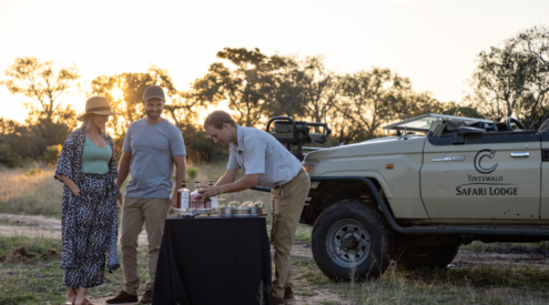
Be sure to check out any of the great Hout Bay restaurants.