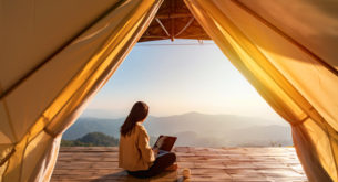

Although a visit to the Kruger National Park tends to be motivated by wildlife sightings rather than beautiful views, the lookout points in the park are much more reliable than the animals’ location. Let me explain. You might not get to see all the animals you hoped you would, but if you make a turn at one of the these lookout points, you’re guaranteed a jaw-dropping view.
So take a break one morning from scrutinising the bush for signs of life and sit back (sometimes inside your car and sometimes on a designated bench), stretch your legs and enjoy the view.
Kruger National Park’s 10 best lookouts
(Note that the lookouts are sorted from south to north, not from best to worst.)
1. Hippo Pools, Crocodile Bridge

Image courtesy of weg.co.za
The view
The Crocodile River marks the southern border of the park and it’s a beautifully wide river separating the lodges and agriculture on the opposite side of the river from the Kruger. At this particular stop along the river you can get quite close to the water, and as the name implies, you can look out for lazing hippos in the water.
Getting there
From Crocodile Bridge Gate (gate times and details), follow the H4-2 north for 3km and turn left onto the S27. Follow this gravel road for 3km and take the turnoff left to Hippo Pools.
GPS coordinates: -25.185059, 31.860352
Need to know
The hangout area is only open Monday-Friday 08h00-15h00 and Saturday 08h00-12h00.
Can you get out of your car?
Yes, between the abovementioned times.
2. Steilberg Loop – Berg-en-Dal Rest Camp

The view
Berg-en-Dal Rest Camp is situated in the hilliest part of the park – hence the name – and hills imply views. The Steilberg Loop takes you to one of the highest points in this region, so you can look out over a great expanse of hills and valleys – not something you would generally associate with the Kruger.
Getting there
From Berg-en-Dal, take the S110 tarred road to the H3 intersection (9.5km); turn left for 2km and right onto the scenic Steilberg Loop. After 6.5km, look out for the turnoff to the lookout point.
GPS coordinates: -25.389706,31.509047
Can you get out of your car?
No
Need to know
The Steilberg Loop is closed for caravans and buses. This is because the road has many steep spots covered in loose gravel.
3. Mathekanyane Lookout – Skukuza Rest Camp

The view
Ideal for the late afternoons when the sun starts setting, Mathekanyane Lookout sits on top of a hill, which is dominated by a massive rock boulder. Walk out onto the boulder as far as you like and look out over a flat stretch of bush. The sun sets straight ahead of you.
Getting there
From Sukuza Rest Camp, take the H3 south for 10km and take a left turn at the Mathekanyane sign. Drive 500m up a steep hill to the top.
GPS coordinates: -25.06720, 31.55152
Can you get out of your car?
Yes. There aren’t any benches to sit on, but the entire boulder is slanted an provides surprisingly comfortable seating.
Need to know
There are no buses and caravans allowed here, because the short road to the top is steep and has a few large cracks. Remember that it takes at least 20 minutes to get back to camp; so don’t get caught up in the sunset and miss the gate.
4. Renosterkoppies – Skukuza Rest Camp

The view
Apart from getting to look out through a gap in the bush and down into a bushy valley far below, you also get to visit the Stevenson-Hamilton Memorial if you stop of at Renosterkoppies. If you’re not inclined toward the history, the view is still rather pretty.
Getting there
From Skukuza Rest Camp, head south on the H1 for 5km and take the S114 left. After 6km, follow the Stevenson-Hamilton Memorial signs. You’ll drive along the S22 for about 3km and then turn left and up a steep hill.
GPS coordinates: -25.10411, 31.59614
Can you get out of your car?
Yes, and you have to walk around a giant boulder along a winding path to get to the actual lookout point, so it’s a great place to stretch you legs.
Need to know
The last little stretch of the road is quite steep, but it’s worth it for the view. Although there are quite a bit of space to park, there’s really only one spot where you can see through the bushes and down into the valley, so you might have to wait your turn. Luckily, this is not a very busy lookout.
5. Nkumbe Lookout – Lower Sabie

The view
The road along which you’ll find this viewpoint traverses a ridge in an otherwise flat landscape. This means that you’ll get to see incredibly far across the western region of the park. The vegetation here is grassy, giving the land a beautiful, smooth shade.
Getting there
From Lower Sabie, drive north along the H10 for 35km and turn left to Nkumbe Lookout.
GPS coordinates: -23.674713, 31.574707
Can you get out of your car?
Yes. There’s a thatched shade where you can sit on the cement benches and perhaps have something to eat or drink (bring this along).
Need to know
If you drive 1km further north from Nkumbe, there’s another viewpoint to the right of the road. This one feels almost higher and you can see incredibly far over the east of the park toward the Lebombo Mountains. You can’t get out at this stop though.
6. N’wanetsi – Satara Rest Camp

The view
Although N’wanetsi is actually a picnic spot (keep a lookout for the park’s top picnic spots next week), it has a separate lookout point that literally made my jaw drop. You get to look down onto a large natural dam in the N’wanetsi River, but you’re so high up that you can see a massive expanse of the surrounding bush.
Getting there
From Satara Rest Camp, head south on the H1 for 5km and turn left onto the H6. Follow this road to its end (20.5km) and you’ll see the signs to N’wanetsi Picnic Spot. To the left of the thatched sitting area there’s a steep little path leading up to the viewpoint.
GPS coordinates: -24.45774, 31.97633
Can you get out of your car?
Yes, you can even make a picnic.
Need to know
Bring you binoculars if you want to try and spot animals, but you’re really so far up that merely enjoying the stretch of land in front of you is pleasing enough.
7. Bobbejaankrans – Orpen, Tamboti, Maroela

The view
Bobbejaankrans sits high above the Timbavati River – a very prominent river in the park and a popular drinking place for animals. There are two lookouts (both with the same name) from which you can gaze out over the river below.
Getting there
From Orpen, drive along the H7 heading east. The first lookout is at 12km and the second at 22km.
GPS coordinates: -24.405985, 31.523659 and -24.40699, 31.57243
Can you get out?
Yes, at both of them. There are also benches to sit on, but the view is better if you stand.
Need to know
When I visited (May 2013) a section of the H7 was closed because of the floods. The first lookout can still be reached via the H7, but to get to the second you’ll have to take the alternative S106 gravel road.
Remember your binoculars as the river is quite far down.
8. Olifants River Bridge – Olifants Rest Camp

The view
The Olifants River marks the border between the south and the north of the park. It literally marks a distinct divide in vegetation, making it a very prominent river in the park. The high-level bridge that crosses it is 300m long and creates a very surreal, but rather awesome, feeling of being suspended high above this broad stretch of water.
Getting there
From Olifants Rest Camp, head west along the H8 tarred road for 9km and then follow the H1 for another 6km.
GPS coordinates: -24.013853, 31.651611
Can you get out of your car?
Now this is interesting. Around the middle of the bridge you’ll see two yellow lines. In between these, you can park and get out of your car, walking along the bridge and spotting birds and animals in the water.
Need to know
Heading further north after crossing the river, the road follows the Olifants River for a few kilometers and there are numerous river loops where you can pull over and look out across the river from your car. These are nice if you feel that there are too many people on the bridge.
9. Letaba River Bridge – Letaba Rest Camp

The view
Much the same as at Olifants River, the high-level bridge at Letaba River runs high above the water. Although it’s only half the width of the Olifants River Bridge, the views aren’t any less spectacular and you’re likely to see hippos bathing on the sanbanks.
Getting there
From Letaba Rest Camp, head out to the four-way stop and turn right onto th H1. Continue north for 5.5km until you reach the bridge.
GPS coordinates: -23.812124, 31.582131
Can you get out of your car?
Much the same as at Olifants, you can get out in between the yellow lines painted across the road. The area is much smaller than at Olifants, but still allows a nice little walk along the bridge.
10. Thulamela – Punda Maria Rest Camp

The view
High up north, in the Pafuri region of the park, you’ll once again encounter an area with numerous hills. These are nothing compared to the hilly landscapes down at Berg-en-Dal, but seeing as this area of the park is reasonably flat, the specific hill at the end of the ThulamelaRoad allows just enough height in order for you to enjoy sweeping views across the landscape.
Getting there
From Punda Maria Rest Camp, drive the 5km out and turn right onto a gravel road leading to the Punda Maria Gate. After 3.5km you’ll see the turnoff to the right named Thulamela. This road is about 3km long and (after keeping left at the fork) you’ll head up a steep, straight road. At the top there’s a small loop where you can park.
GPS coordinates: -22.722278, 31.003504
Can you get out of your car?
No, you’ll have to stick to your car for this one.
Need to know
At the actual loop at the end of the gravel road, the view is a little blocked by the vegetation and because you can’t get out, you can’t see very well. But, driving back for 1km you’ll reach the top of the hill that you just ascended and from here you can see much further down across the landscape. The road here is quiet, so you don’t have to worry about blocking traffic.