


Sehlabathebe National Park is one of just three national parks in Lesotho. Located in an eastern crook, where the Maloti Mountains greet the sunrise, it is a compact wilderness where Cape vultures soar and jackals scavenge in afternoon shadows.
Getting there from South Africa is easy – a gravel road from the Ramatseliso’s Gate border post (S30° 2.989’, E28° 56.042’) takes you north along large, looming Drakensberg peaks and small settlements. But the adventure is getting there from the west, from the town of Thaba-Tseka.
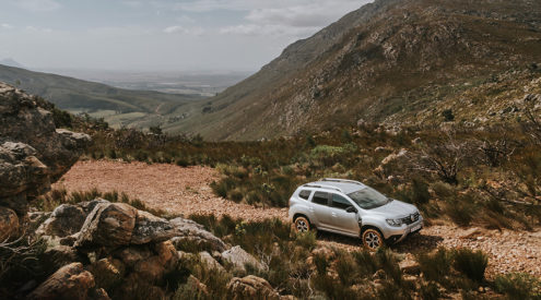
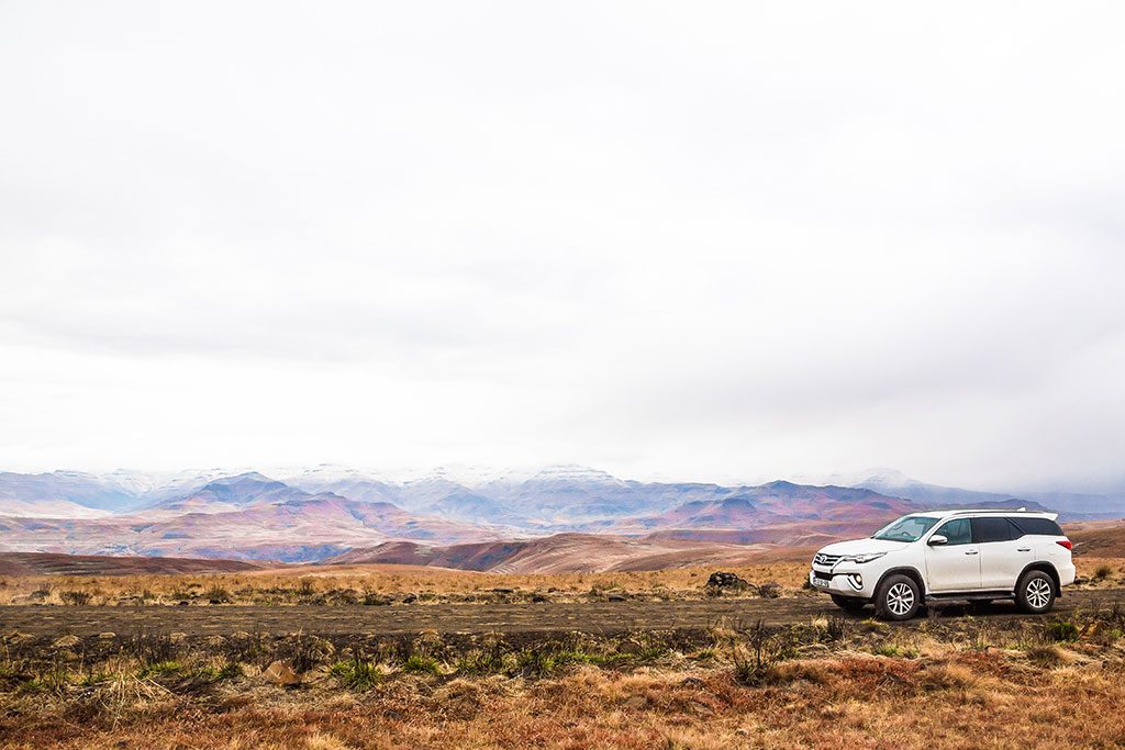
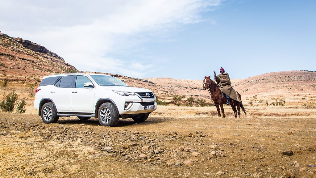
Thanks to our Toyota Fortuner, we opted for the adventurous option.
Also read: Our favourite Lesotho route to explore Katse Dam
Also read: The golden way to Ts’ehlanyane in a 4X4
The secret road to Sehlabathebe
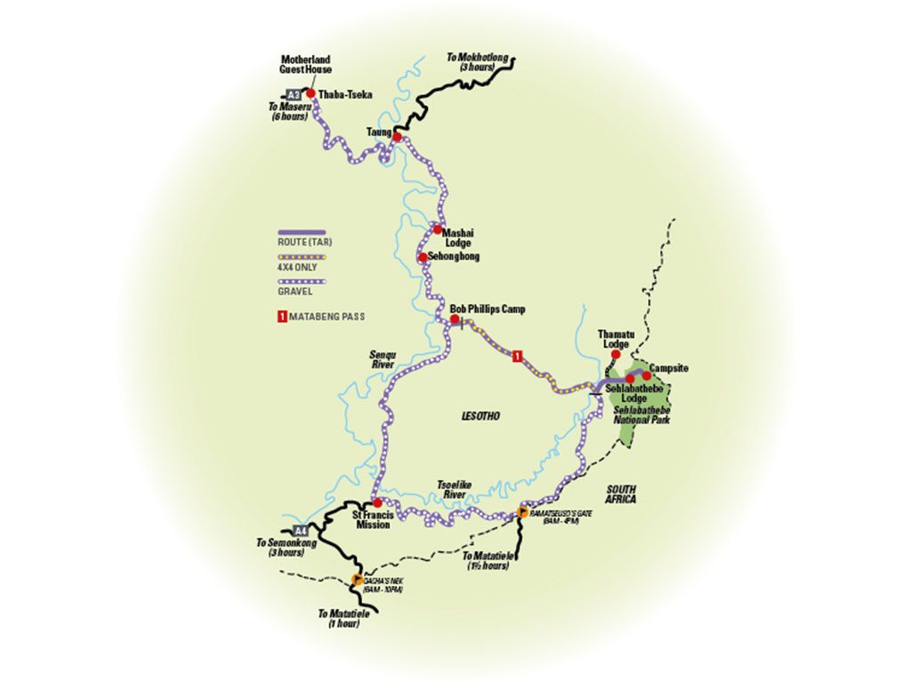
Thaba-Tseka to Sehlabathebe National Park
Grade: 3/5 – Challenging. 4X4 essential, some off-road experience is required.
Days: 2
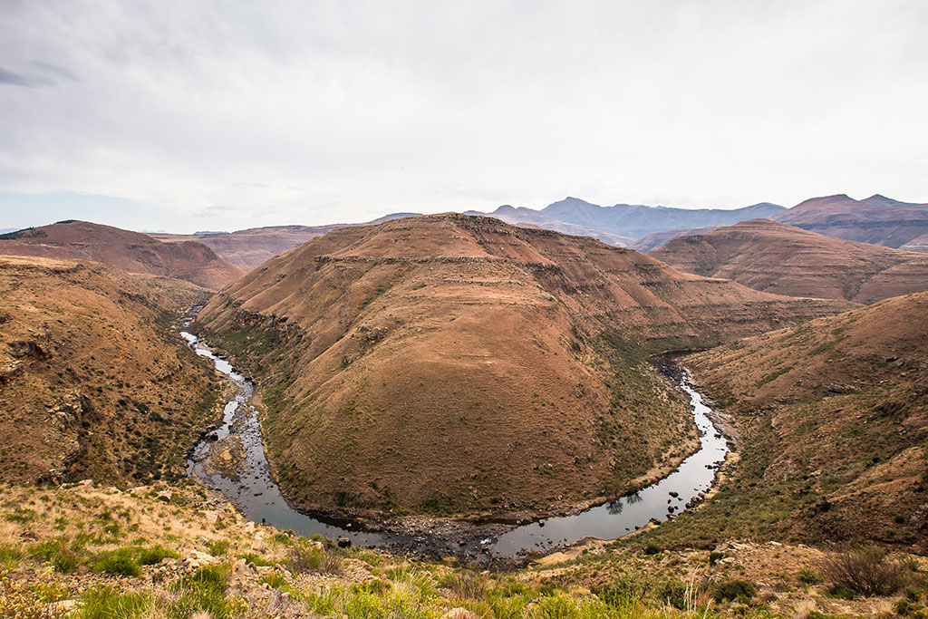
It’s a full day of off-road driving (allow at least seven hours). Towards the end of a gravel road from Thaba-Tseka to Taung is where you’ll first meet, and cross (via a bridge), the Senqu River – South Africa’s life-giving artery, the Orange River. The road from Taung tracks the river south, high above magnificent horseshoe bends. This road continues past the village of Sehonghong (S29° 43.702’ E28° 46.385’) and then reaches a junction (S29° 48.475’ E28° 49.194’) where a decision must be made.
Keep left and you’re soon at Bob Phillips Camp. It’s no more than a patch of land next to the Matabeng River – there is no power, cell reception or ablutions – but it marks the start of Matabeng Pass. This is the route to Sehlabathebe for those who want to test their 4x4s, and their mettle.
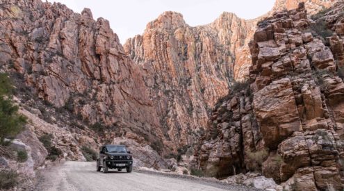
Keep right at the junction and you’ll be on one of Lesotho’s ever-increasing enigmas – a new, just-graded, unmapped, gravel road. Heading south with the Senqu River on your right and the western slopes of the Drakensberg on your left, the road climbs and twists upwards. There are some loose rocky sections, small bridges (some were already in danger of washing out at the time of travelling) and steep descents, but it’s staying on the track itself that is the biggest challenge – village roads shoot off in both directions, unmarked and unnamed.
When in doubt, keep heading south-east and aim for the cell tower (S29° 55.494’, E28° 43.862’), which marks the start of the descent to St Francis Mission. The navigation from here gets easier, although some of the descents are steep enough to warrant low range. It’s a magnificent drive though, and you’ll pass herdboys and smoke-wisped huts before crossing the Tsoelike River and taking the gravel road east past Ramatseliso’s Gate and on to Sehlabathebe.

There are two accommodation options – a ramshackle campsite next to the ruins of the old Sehlabathebe Lodge (S29° 52.128’ E29° 06.977’) and the just-built Sehlabathebe Lodge (S29°52.700’E29°04.532’) about 2.5 kilometres from the park’s incongruously grand reception area.
At the time of writing, the lodge rondavels did not yet have water or electricity but reports are it will be fully operational by January 2018. The new accommodation is neat and will be worth a stay when fully serviced. However, given the park’s history of mismanagement it’s not something you can count on. Still, Sehlabathebe is worth a visit for hiking and bird watching alone and there is accommodation just outside the park if things at its lodgings remain problematic.
Sehlabathebe route map
Road conditions
The roads on this route are all gravel and graded but in varying states of disrepair. The track from Thaba-Tseka to Taung is severely worn and large dongas are part of the package. Conditions are a bit better from Taung to Sehonghong. Matabeng Pass is very tricky and for experienced 4X4 drivers only (go in convoy and avoid if it’s wet). The ‘new’ road from Bob Phillips Camp to St Francis Mission is relatively good, and east from there to Sehlabathebe is well-graded but rocky and steep in sections.
Driving tips

Steep descents can be tricky if not approached properly. Slow down with the engine rather than the brakes to avoid locking the wheels. Select a low gear, take your foot off the clutch and only feather the brakes lightly if necessary. If your vehicle is fitted with DAC(downhill assist control), engage that.
Stay here
Motherland Guesthouse, Thaba-Tseka (S29° 30.779’, E28° 36.270’) has neat rooms, a restaurant and bar. From R350 per person sharing B&B. Tel +26663040404
Bob Phillips Camp (S29° 48.542’, E28° 49.526’) costs from R25 per person, payable to Johannes Motlatsi on arrival. Tel +26656556174
Sehlabathebe Lodge and Campsite (S29° 52.204’, E29° 4.057’) has rondavels from R280 per person sharing and camping from R100 per perso (prices subject to change). Tel +26622312427
Thamatu Lodge, Thamatu Village (S29° 50.979’, E29° 03.832’) is about 20 minutes from Sehlabathebe. From R200 per person and R100 per day service fee. Tel 0824125540
Activities
Horse riding in Sehlabathebe is from R150 per person and R30 per person conservation fee. Book at reception.
Hike to the beautiful waterfall on the Tsoelikane River. R30 per person conservation fee. Payable at reception.
This Lesotho 4X4 route was researched and travelled to in association with Toyota.