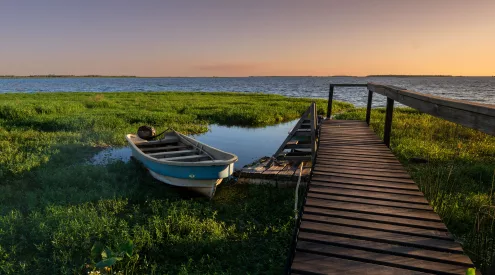


On the walk down from Serra do Topo, you get your first look at Fajã da Caldeira de Santo Cristo while there’s still a fair bit of downhill to go. Below you, a narrow strip of land separates the lagoon from the Atlantic. The village sits on a small shelf at the foot of the cliffs. From up here, it’s easy to see why the people who made a home on this stretch of coast made use of every bit of flat ground they could find.

Amazing fajã with deep green and blue colors on São Jorge, Azores / Karim Sakhibgareev / Unsplash
These coastal flats are called fajãs. São Jorge has more than 70 of them. Some formed when rock and earth fell from the cliffs and collected at their base. Others took shape as lava flowed into the sea. UNESCO added the island and its surrounding waters to its network of biosphere reserves in 2016. A walk down to the north coast gives you a closer look at the landscape behind that designation, from the plants that grow in the highlands to the villages tucked beneath them.
From Serra do Topo to the first lagoon
The walk begins beside the wind farm at Serra do Topo, about 700 metres above sea level. Look for Azorean heather, juniper and holly along the dirt track before the path starts dropping towards Caldeira de Cima. After the Tia Júlia bridge, a short detour leads to Cascata Pequena. The ground can be slippery here, so take your time if you go down to see the waterfall. Farther along, the Santo Cristo lagoon comes into view.
Down in Santo Cristo, the lagoon tells you something about how people have worked with the land. A channel to the ocean is kept open to help sustain the clams for which the village is known. Resident and migratory birds also use the lagoon. If the interpretation centre is open when you pass through, it’s worth a stop. It occupies a former home, still with its traditional frontage, and has a recreated oven and exhibits about the geology and daily life of the fajãs.
Along the coast to Fajã dos Cubres
From Santo Cristo, the path follows the coast past Fajã do Belo, where people lived until the 1980 earthquake. Look out for the wire cables along this stretch. They were used to move firewood down to the settlements, a small detail that makes it easier to picture what getting supplies to homes under these cliffs once involved. The trail ends near the church of Nossa Senhora de Lourdes at Fajã dos Cubres, where there’s another lagoon and a village with its own history of rebuilding after earthquakes.
A longer walk from the volcanic ridge
If you have another day and good visibility, start near Pico do Pedro and follow the central ridge towards Fajã do Ouvidor. A signed detour takes you to Pico da Esperança, the island’s highest point at 1,053 metres, where you can walk around the crater and look down at the lake. Back on the main route, the descent takes you through woodland and along farm roads before reaching the north coast.
At Ouvidor, the ground beneath the village has a different history. Lava formed a wider shelf here, with enough room for the settlement to grow around a small fishing harbour. If you’ve already walked through Santo Cristo and Cubres, you’ll have a feel for how much the shape of each fajã has influenced what people could do with the land.
Plan your walk
- Serra do Topo to Fajã dos Cubres (PR01SJO) is about 10km one way. Azores Trails rates it moderate and gives an average walking time of two and a half hours. Leave extra time for the waterfall and a stop at Santo Cristo.
- Pico do Pedro to Fajã do Ouvidor (PR04SJO) is 16.9km one way. Azores Trails rates it moderate and gives an average walking time of four hours. Save this one for a clear day.
- Sort out transport before you set off. Both walks finish away from their starting points, so arrange a taxi or a lift. Pack water, shoes with good grip and a waterproof layer. Check the trail alerts before you leave.
- Getting to São Jorge. SATA Air Açores operates inter-island flights to São Jorge. Atlânticoline’s Green Line links Velas with Pico and Faial. Check the timetable for your dates.
If you only have time for one walk, give Serra do Topo to Cubres a whole morning. Take the waterfall detour if the ground is good, linger by the lagoon at Santo Cristo and leave yourself a few minutes by the church before your lift arrives. Then look back up at the cliffs. From down there, you can see just how little space there is between the hillside and the sea, and how much people made of it.
Follow us on social media for more travel news, inspiration, and guides. You can also tag us to be featured.
Instagram | Facebook | Twitter | Spotify
ALSO READ:
Rwanda’s volcanic caves: Exploring the underground world beneath the Virungas