


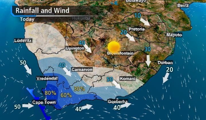
A cold front has made landfall in the Western Cape on Monday, June 28 resulting in widespread rain and the South African Weather Service (SAWS) issued several weather warnings.
“These conditions may result in difficult driving conditions during the morning commute, with localised flooding possible especially over the Cape Metropole, the Cape Winelands and the southern half of the West Coast District,” the SAWS said.
Strong winds of 40-60 km/h are forecasted for the interior of the Western and Northern Cape from Sunday afternoon into Monday, which may result in problems for high-sided vehicles on major roads. Light snowfall is possible over the western high-lying areas of the Western Cape from Monday late afternoon into early Tuesday morning, with cold to very cold conditions expected.
Rainfall is likely to continue over the Western Cape and western and southern parts of the Northern Cape on Tuesday, Wednesday and Thursday, as yet another two cold fronts are likely to impact these areas.
In contrast, ‘Spring-like’ weather is predicted for the north-eastern parts of the country this week with maximum temperatures in the low to mid-twenties, but warm to hot temperatures can be expected in the Lowveld of Mpumalanga and Limpopo and the eastern parts of KwaZulu-Natal on some days.
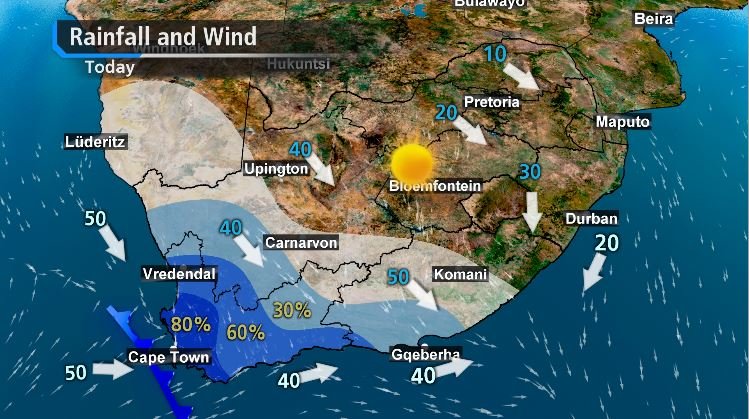
Credit: SAWS
The SAWS issued the following warnings for the Western Cape:
1. Orange level 5 warning for RAIN resulting in flooding is expected over the City of Cape Town.
2. Yellow level 2 warning for RAIN resulting in localised flooding is expected over the southern parts of the West Coast, Cape Winelands and Overberg Districts of the Western Cape.
3. Yellow level 2 warning for WIND leading to difficulty in navigation at sea is expected between Cape Columbine and Cape Agulhas.
4. Yellow Level 2 Warning for WAVES resulting in difficulty in navigation at sea is expected between Cape Columbine and Plettenberg Bay.
5. Yellow level 2 Warning for WIND resulting in problems for high sided vehicles, localized power interruptions and localized infrastructure damage is expected over the West Coast, Cape Winelands and Central Karoo of the Western Cape, the southern Namakwa District and south-eastern parts of the Northern Cape and the Sarah Baartman, Chris Hani, Joe Gqabi and Raymond Mhlaba Districts of the Eastern Cape.
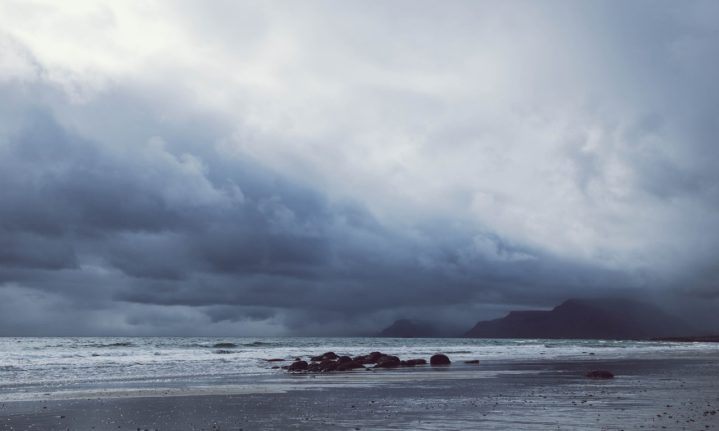
Picture: Pexels