


The National Aeronautics and Space Administration (NASA) released a remarkable photo series that shows just how much the planet has transformed in years long gone and also very recently.
The series is called Images of Change and it shows how climate change, urbanisation, and damage wreaked by natural disasters such as droughts, floods, hurricanes and more by displaying side-by-side photographs of a particular area.
Here are a select few:
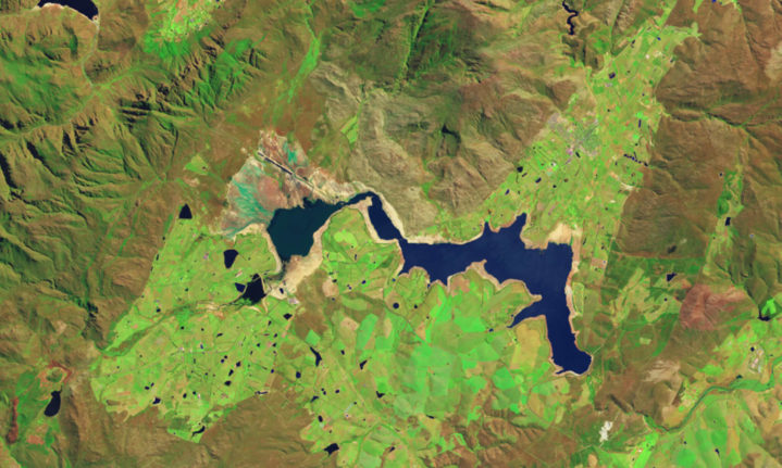
Drought shrinks Theewaterskloof reservoir in South Africa
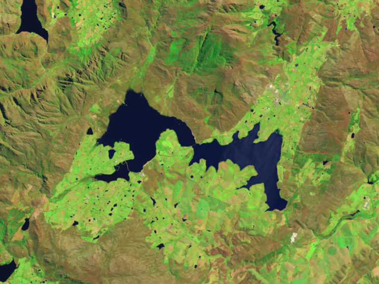
Oct. 18, 2014
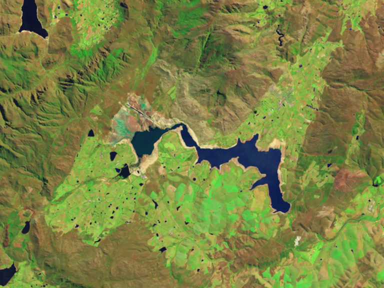
Oct. 10, 2017
‘South Africa’s Western Cape province has been suffering a drought since 2015, when it received about 60 percent of its normal rainfall. Rain amounts continued to plummet in the two subsequent years,’ said NASA.
The above images show Theewaterskloof at full capacity in October 2014 and at 27 percent capacity in October 2017.
The exposed sediment around the edge of the basin in the 2017 image shows how the water level declined.
Images taken by the Operational Land Imager onboard the Landsat 8 satellite. Source: NASA Earth Observatory.

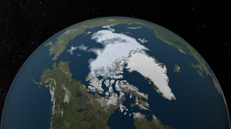
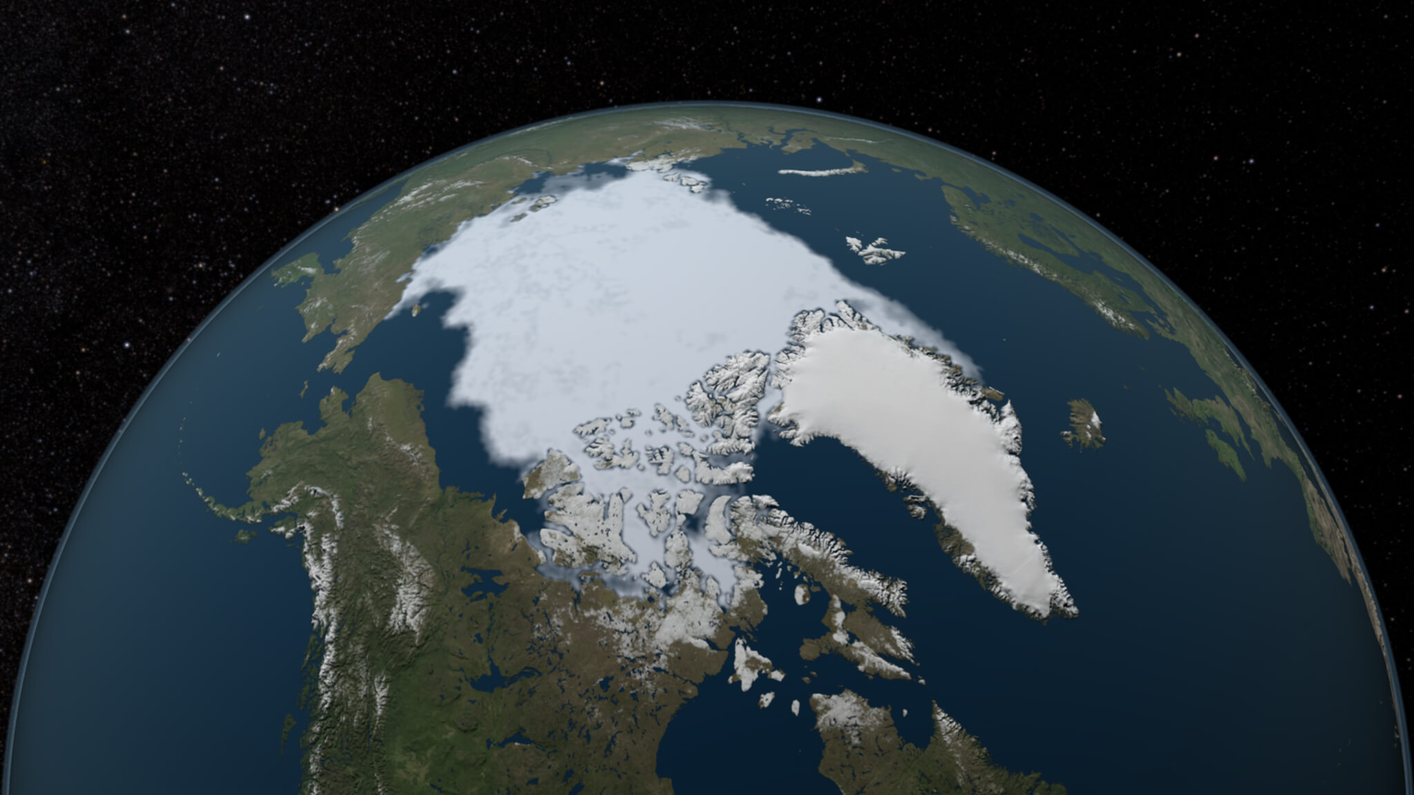
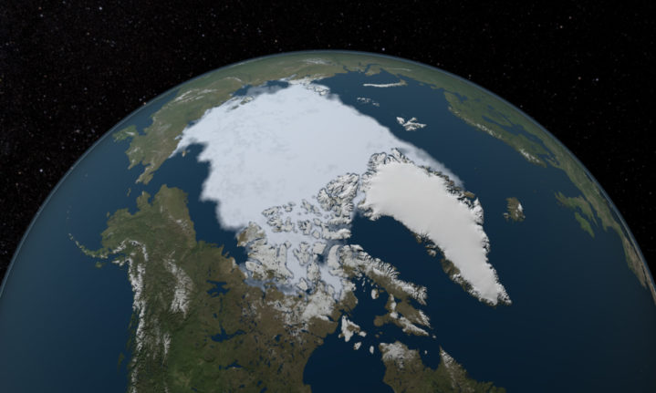
‘The area of the Arctic Ocean covered in ice increases during the winter and then shrinks during the summer, usually reaching the year’s low point in September,’ said NASA.
‘The minimum coverage for 2012 set a record low since at least 1979, when the first reliable satellite measurements began.’
‘At the rate we’re observing this decline,’ said NASA scientist Joey Comiso, ‘it’s very likely that the Arctic’s summer sea ice will completely disappear within this century.’
Images by NASA Scientific Visualization Studio. Information sources: 2012: NASA Earth Observatory, 2013: NASA Earth Observatory, 2016: NASA Global Climate Change.
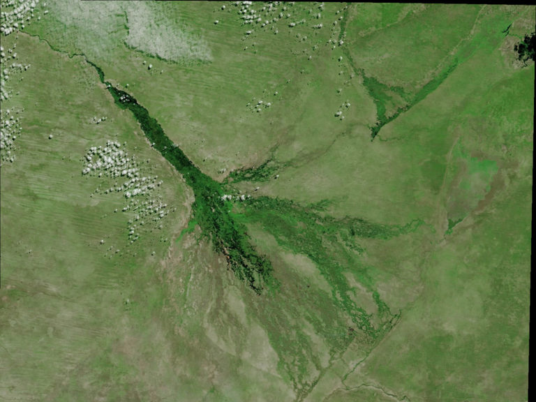
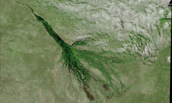
April 28, 2018
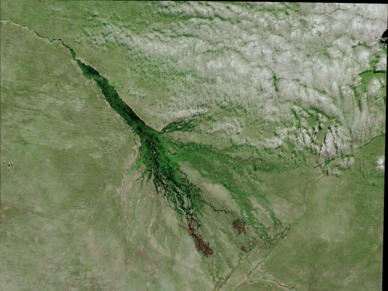
May 23, 2018
‘These images show the progression of both fire and flooding in the Okavango Delta of northern Botswana, one of the world’s largest inland deltas,’ said NASA.
The Okavango floods annually and the water from seasonal rainfall travels nearly 20,000 square kilometres of wetlands.
The flooding encourages the growth of vegetation, which NASA says people often set on fire before the next flooding event.
‘In these images, composed from a combination of visible and shortwave infrared light, burn scars appear dark brown, fire at the tip of the lower scar is bright orange, vegetation is bright green, bare ground is light brown and water is dark blue.’
Images taken by the Moderate Resolution Imaging Spectroradiometer (MODIS) instrument on NASA’s Terra satellite. Source: NASA Earth Observatory
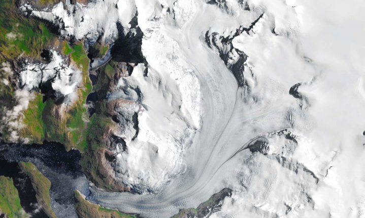
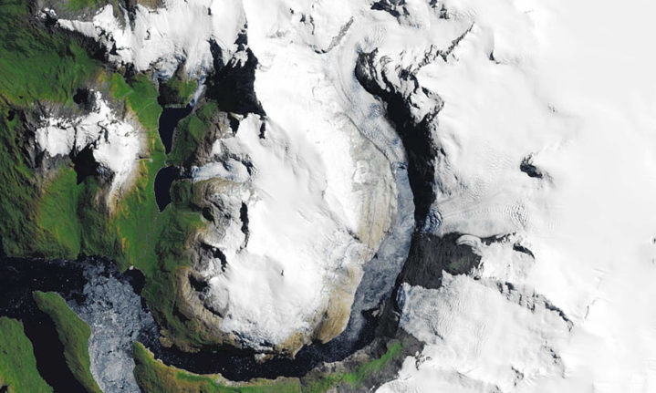
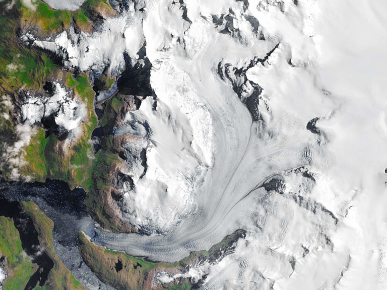
South Patagonian glacier beats a hasty retreat
Jan. 27, 1985
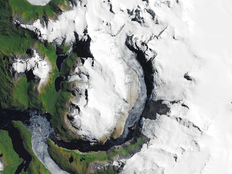
Feb. 4, 2017
‘The South Patagonian Ice Field spans about 5,000 square miles (13,000 square kilometers) across Chile and Argentina, the Southern Hemisphere’s largest contiguous ice field outside of Antarctica,’ said NASA.
‘Most of its glaciers have been decaying, with several undergoing catastrophic retreat. The glacier shown here, designated “HPS-12,” has shrunk from 16 miles (26 kilometers) long in 1985 to 8 miles (13 kilometers) in 2017, detaching from three other glaciers in the process.’
Images taken by the Thematic Mapper on Landsat 5 and the Operational Land Imager on Landsat 8. Source: NASA Earth Observatory.
To view the full series of remarkable images in an interactive gallery that allows viewers to toggle between the images and compare the differences more comprehensively, visit Images of Change.
Picture/s: NASA