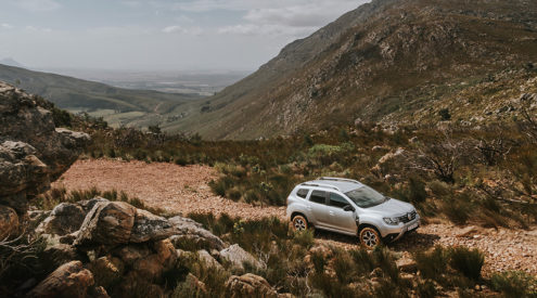

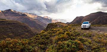
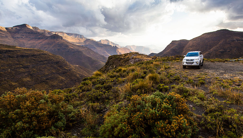


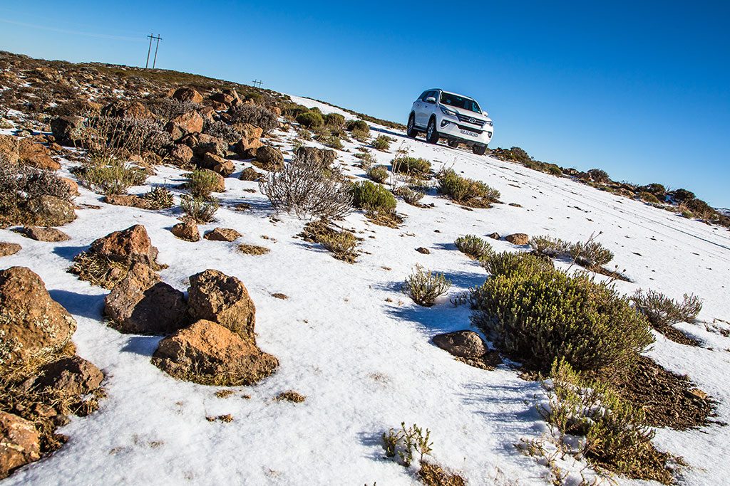
There’s an off-the-beaten-track loop in Lesotho’s grand north that combines the quiet isolation of the Maloti Mountains with some fun 4X4 driving.
Adding to the already spectacular drive along the country’s now-tarred A1 makes for an epic three-day (or more) road trip. Especially in a Toyota Fortuner.
Also read: Our favourite Lesotho route to explore Katse Dam
Also read: The secret road to Sehlabathebe
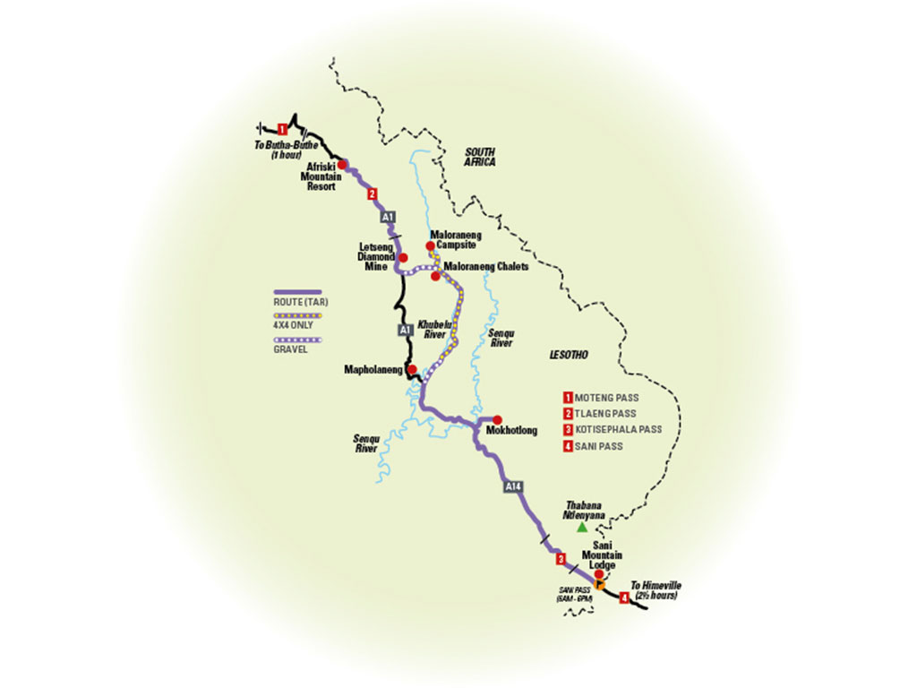
The Khubelu River meander
Afriski Mountain Resort to Sani Mountain Lodge
Grade: 4/5 – Difficuly. 4X4 essential. Good off-road experience required (route contains water crossings or steep, trciky sections). Convoy recommended.
Days: 3
It’s possible to get to the first overnight stop from Clarens in SA, but if you start off a little closer, at Afriski Mountain Resort, you can enjoy a host of winter or summer activities, its mountain chalets, cosy bar and dining area before heading up to the stark northern peaks and quiet valleys.
It’s about 30 kilometres from Afriski Mountain Resort to the Letseng Diamond Mine (S28° 59.750’ E28° 51.438’) on the tarred A1. Soon after the mine, look out for a sign that reads ‘Maloraneng Chalets & Camp Site – 9km’ and turn left onto the gravel road (S29° 1.360’, E28° 51.392’).
It’s an easy half-hour drive to Maloraneng village and, just past it, Maloraneng Chalets, also known as ‘Chalets in the Sky’. The thatched rondavels are remote, simple and beautiful. There are six self-catering chalets that sleep two comfortably (a sleeper couch can be folded out for two children or an extra adult). A generator provides power and there are gas stoves and fridges.
The campsite, about an hour’s drive away, on a bend on the Khubelu River, rich in yellowfish and trout in the summer is even better. But access is seasonal (when the river is low enough to cross) and by 4×4 only. To get there from Maloraneng Chalets, drive back past the village and cross a small Khubelu tributary (S29° 0.496’, E28° 55.744’) and get onto a 4×4 track that cuts its way along the mountainside before crossing the Khubelu River (S28° 59.808’, E28° 56.047’). The route tracks the Khubelu north, towards its source, along high rocky slopes and past glistening straw huts with smoke rising from their chimneys before descending to the river to cross it one more time (S28° 58.896’, E28° 55.437) to reach the campsite on the other side.
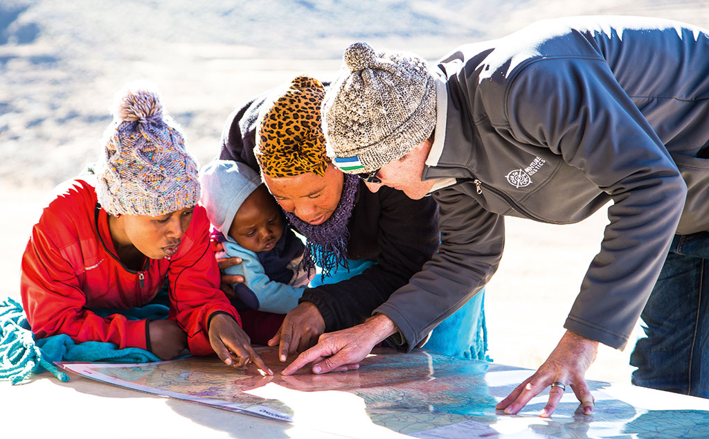
The following day, track back along the 4×4 route to Maloraneng Chalets, from where you’ll follow the Khubelu River in the opposite direction all the way back down to the tar A1 (S29° 13.228’, E28° 54.253’). There are many river crossings on this route and it’s best done in winter when the water is at its lowest. The riverbeds are rocky but relatively consistent, with a few deep patches. You’ll climb and descend a slew of splendidly unkempt mountain roads, past herdboys and dawdling cows, over rocks that crunch and tumble to the earth below. Small villages dot the route, with ‘roads’ that fork out in every direction, and it can get a little confusing.

Luckily you’ll have the Khubelu River in sight for most of it, so keep following it south. If you’re not confident, ask for the direction to Mapholaneng (it’s always better to ask more than one person), which is just west of where you’ll exit on the A1. The drive from the campsite to the A1 takes about six hours at an easy pace. Thereafter you’ll cruise over the Senqu River and down to Mokhotlong where an ATM, fuel and supplies are available.
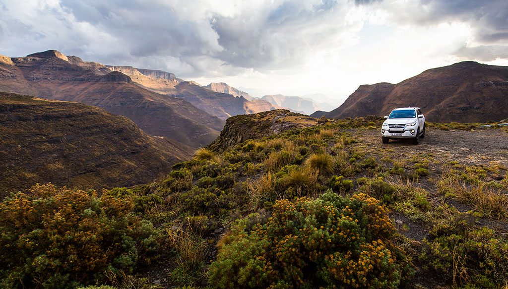
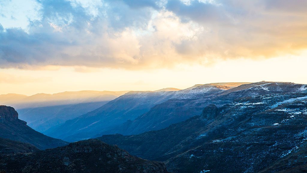
From Mokhotlong, take the A14 south towards Sani Mountain Lodge, winding down the scenic Kotisephala Pass. Look out for Thabana Ntlenyana, Southern Africa’s highest peak and the highest south of Kilimanjaro, on your left as you descend to Sani Mountain Lodge’s magnificent rondavels, perched at the top of Sani Pass. Book dinner and cosy up in the bar for a drink.
Road conditions
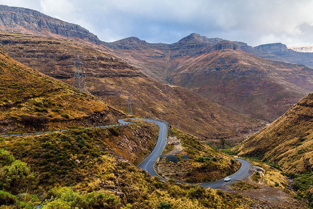
The tar A1 and A14 are in very good condition, but if you’re driving in winter look out for black ice on the passes – especially on Tlaeng and Kotisephala. The gravel sections are mostly good.
Driving tips
Always get out of your vehicle and check a river’s depth before crossing. You can use a stick but it’s best to take o your shoes and walk in to check the depth at the centre. This way you can also check for holes or large rocks that may impede your progress. Select second gear and low range and aim for a point on the opposite bank on a line you know is free of obstacles and proceed slowly and steadily.
Khubelu River Meander map
Stay here
Afriski Mountain Resort (S28° 49.354’, E28° 43.684’). From R420 per person sharing in a lodge (sleeps two). Tel +26659544734
Maloraneng Chalets and Campsite (S28° 58.827’, E28° 55.522’). Chalets from R300 per person; campsite R100 per person. Tel +27635123016
Sani Mountain Lodge (S29° 35.072’, E29° 17.301’). From R1348 per person sharing DBB. Tel +26653098674
Activities
Go skiing at Afriski Mountain Resort. From R450 per person for a day pass and R395 per person for gear rental. If you’re there in summer, downhill mountain biking costs R150 per person, which includes a day pass for the ski lift. It also offers bumboarding for those not keen on heights. Tel +26659544734
Go fishing at Maloraneng. It’s included in the camping price but you need your own gear.
Hike and cycle at Sani Mountain Lodge. Take a guided day hike to Thabana Ntlenyana for R500 for two or explore the area on your own bike. Tel +26653098674
This Lesotho 4X4 route was researched and travelled to in association with Toyota