The ultimate Kruger National Park driving map Posted on 19 May 2021 Tags:Kruger, Kruger National Park, map 
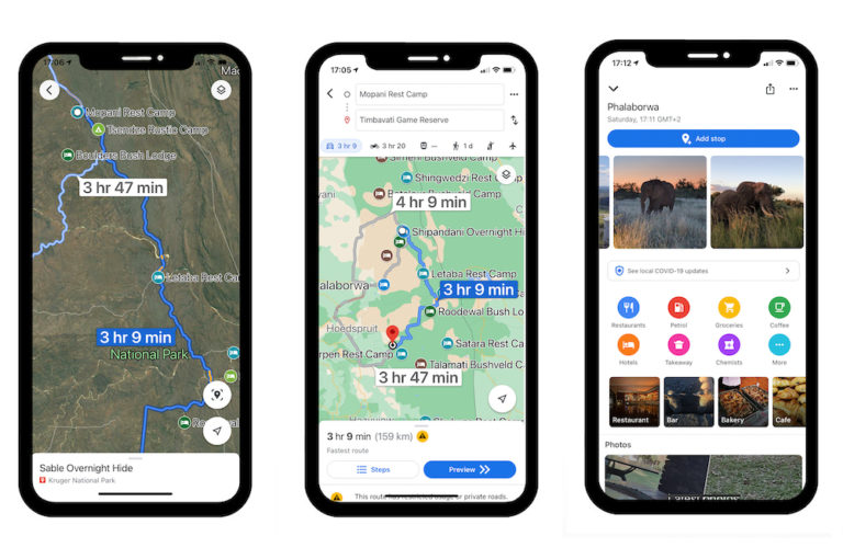
The Kruger National Park ranks among the best in Africa. The park offers a huge variety of wildlife and ecosystems over a vast area, so it’s vital to use a map to navigate the enormous park. 
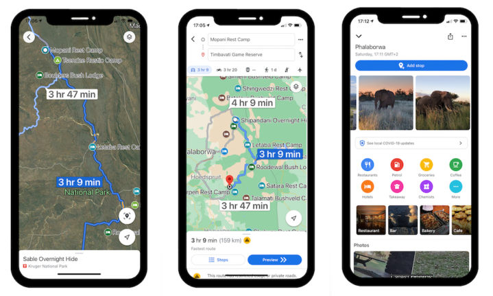
Click here for our Google Map of Kruger National Park. It will open in Google Maps on your phone. Then you can navigate to all the points we’ve highlighted so you can work out travel times, distances, where to camp or find lodging, fuel, restaurants and more.
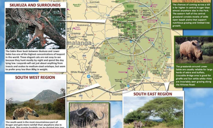
 Or check out the Ultimate Kruger National Park Map from kruger.co.za for everything you need to know about Kruger National Park. This useful map highlights the many diverse areas of Kruger. It includes fun wildlife and historical facts, as well as rainfall, elevation, vegetation and geology maps. Read about the best Kruger campsites north to south. Check out these awesome driving routes in the south of Kruger National Park. Related Posts Wonderful Wupperthal – a humble dorpie in the Cederberg 24 May 2022 The white thatched buildings were the first thing I noticed when we drove into Wupperthal,... read more Things to do for sport lovers at Sun City Resort 24 May 2022 With more than 30 restaurants to choose from at Sun City, and a choice of... read more Discover historic Stellenbosch in the heart of Joburg 24 May 2022 The Spier Wine Experience at the Indaba Hotel is the first of its kind space... read more PREV ARTICLE NEXT ARTICLE
Wonderful Wupperthal – a humble dorpie in the Cederberg 24 May 2022 The white thatched buildings were the first thing I noticed when we drove into Wupperthal,... read more
Things to do for sport lovers at Sun City Resort 24 May 2022 With more than 30 restaurants to choose from at Sun City, and a choice of... read more
Discover historic Stellenbosch in the heart of Joburg 24 May 2022 The Spier Wine Experience at the Indaba Hotel is the first of its kind space... read more