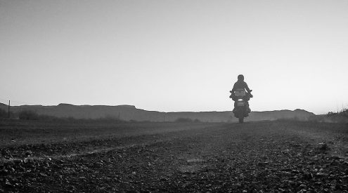

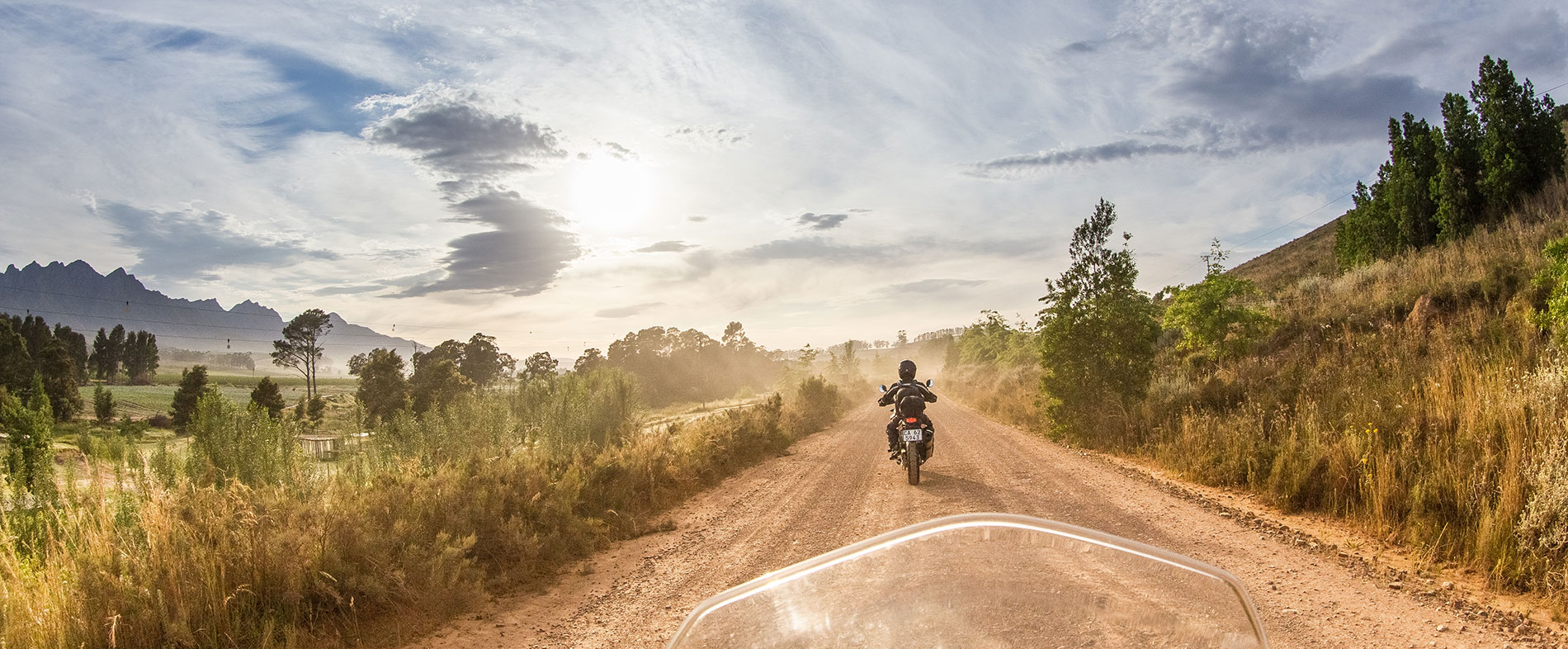


It’s every adventure motorbiker’s dream to ride a beautiful, challenging dirt road. Even better when it’s for the first time. Chris Davies and Tyson Jopson did that on this spectacular motorbike route through the Overberg, in search of the best dirt route between Cape Town and Mossel Bay.

We were about 15 kilometres off the N2 when we first hit the dirt. If you’ve ever ridden a motorcycle on a gravel road for the first time, it’s something you’ll never forget – it feels like roller-skating on marbles. We pulled over to let the tyres down for some extra grip. We’re both experienced off-road riders with our own adventure bikes, but with two very shiny and very borrowed KTMs beneath us we weren’t taking any chances.
With the tyres at optimal pressure (Chris had, just a few minutes previously, inhaled two pies at Peregrine Farm Stall, so I imagined he wouldn’t need to deflate his too much with all that extra bulk he was now carrying), we wound our way south over the Highlands Pass, climbing ever higher above the Elgin Valley before dropping down onto the tarred R43 which links Hermanus and Botrivier. We weren’t interested in either. Our aim was to get to Mossel Bay on as much dirt as possible so, suffering a five-kilometre tar zigzag north, we leaned into the first right, crossed the Bot River and turned immediately left onto the loose gravel to Caledon.

Looking into the Elgin Valley from Highlands Road.
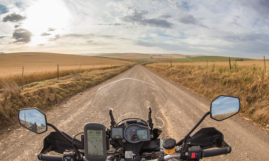
Confidence in our dirt-riding abilities came back quickly. Chris had the GPS – a Garmin Montana loaded with Tracks4Africa – and rode ahead, leaving me inside my helmet to think about the Romans. They weren’t the first to build roads, and they certainly never invented tar. But their legacy to modern travel rings loudest. They circumvented tough or challenging terrain in the interest of expediency, avoiding mountains and cutting through hillsides, and racing their sprung carriages above the earth by a few cobbled centimetres. Of course, as history has shown, we quite liked many of the things the Romans did, and today we race around on raised tarmac in modern air-conditioned carriages cocooned in steel, reducing the outside world to glass-faced vignettes that whoosh by. Our bikes seemed more like chariots: open and bare, kicking up stones beneath our boots and leaving us exposed to the elements above, instant and inescapable.
Also read: The 10 Best Things To Do in Mossel Bay
We reached the entrance to Paardenkloof Estate, turned left and picked our way down a steep, rocky trail where a gate barred the way at the bottom of the valley. In a car, the gate-opening responsibilities are clear-cut – it’s the duty of the one without the wheel in his hand. On a bike, it’s whoever caves first. I looked at Chris, he at me. I caved, figuring there would be more gates later (there weren’t). Rear wheels spinning, we climbed back up an equally steep, extremely loose track, the trickiest riding of the entire trip, and crested onto a graded farm road through golden fields. Sheep and wind turbines studded the pastures as we cruised into Caledon from the southwest, by far its prettier side. Rounding the back of Caledon along the railway line, we crossed the N2 and were briefly back on tar before finding a dirt road north, then east along Riviersonderend, through gorgeous orchards and into Greyton.
Detouring north towards Greyton in the late afternoon.
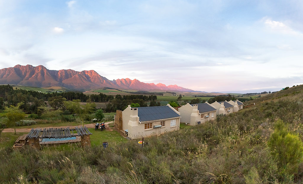
As the last light hit the Langeberg and Riviersonderend trickled away we pulled in at Oewerzicht’s Uitsig cottages – dusty, hot and delighted. We braaied steaks and drank whisky. Our motorcycles heaved like racehorses and ticked and pinged as the metal cooled and contracted.
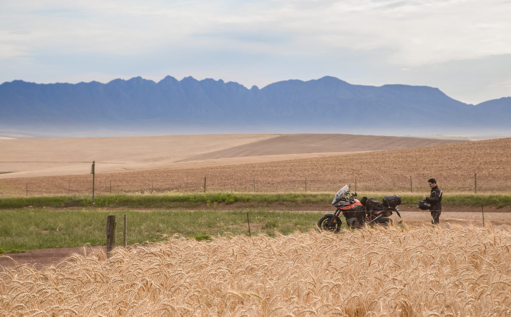
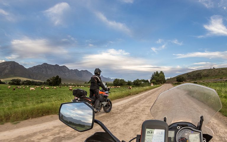
Early the next morning we set our sights on breakfast in Napier, crossing back over the N2 and into a network of graded farm roads that criss-cross the patchwork of farms in the Overberg. It was harvest time. Bakkies left dusty jet streams as workers piled on and off at unmarked intersections. Sheep ran from the fences, blue cranes swooped into the air, harvesters coughed into life and bails of rolled grass glistened in the early light like yellow boulders. It’s easy to forget where things come from: cereal from a box, bread from a packet, fruit and vegetables cradled in cling wrap with a price tag. Riding the Overberg farm roads makes you remember. From the N2, the patchwork fields may look like a still-life painting but when you’re riding between them, they’re alive. We passed labourers tinkering with tractors, windmills and countless bleating sheep. We spent the morning exploring these roads, leaning left where we’d leaned right, stopping to take photos and discuss the route.
Just south of the N2, the quiet, well-graded gravel roads are perfect for biking.
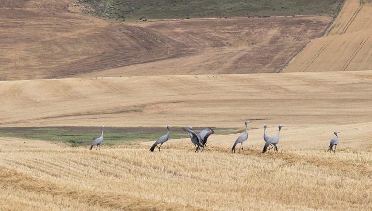
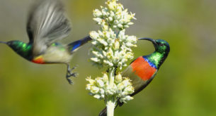
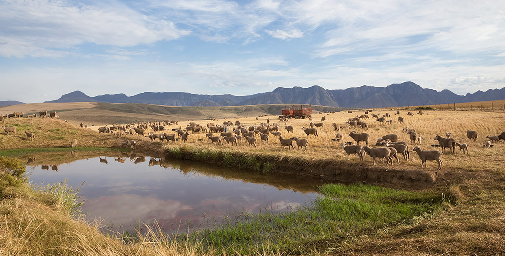
The blue crane is currently listed as vulnerable, but the Overberg Crane Group works hard to protect them.
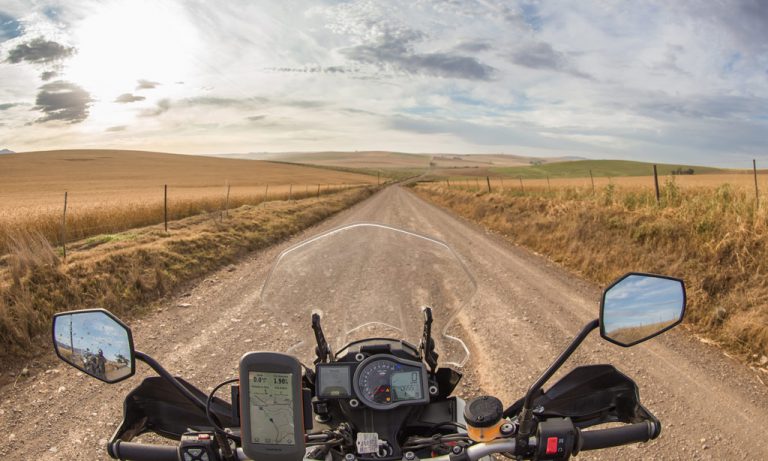
The best way, we discovered, is to cross the R326 and take the drag south-east to Napier, where we pulled in for a bite at Gunner’s Mess. After coffee and a chat we headed up through Klipdale and back across the R317, following dirt all the way except for a short kink south on the R319. From the R319 it was east towards Ouplaas, where we were told there was fuel. There was: a two-pump Total at Overberg Agri. Filled up, we continued east, following the road that skirts north of De Hoop Nature Reserve.

The KTM 1050 Adventure made light work of the Overberg’s endless gravel.
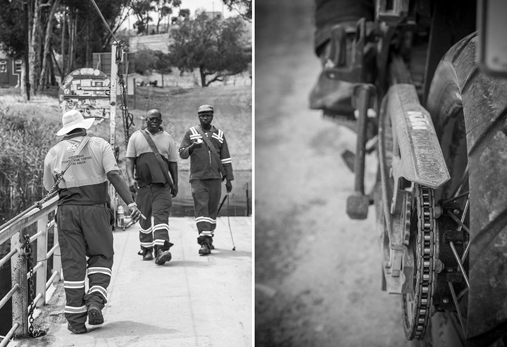
The scenery changed. Spiny aloes and coastal scrub replaced manicured farms. The road widened and we opened our throttles, the occasional pothole no match for the bikes’ incredible suspensions. Hurtling down to Malgas, chasing the smell of the sea, we arrived on the banks of the Breede River where a pontoon ferries vehicles across from 6am to 6pm.

LEFT: The last hand-drawn pontoon in South Africa at Malgas; RIGHT: A different kind of chain power.
After disembarking the pontoon we continued on the well-graded R324 to Witsand and pulled in at PiliPili, a harbour-front restaurant below the Breede River Lodge. There we wolfed down pizza, with chat at a minimum, as quiet men pushed a boat out into the drizzling bay.
The R322 leaves Witsand to the north and after a few kilometres we hooked a right onto a narrow, smooth dirt track towards Vermaaklikheid. They sky was fast turning dark and by the time we got back on the tar, just before the holiday town of Stilbaai, huge dollops of rain were breaking onto our visors. At the Lappiesbaai Restaurant, it was time to make some decisions, eat some burgers and get our rain gear on. We pulled raincoats over our jackets and wet-weather pants over our jeans. Layered, like onions, we set off, and almost immediately the sun came out. The Inverroche Distillery, just north of town was a great excuse to stop and lose a few garments, and a few rands too (we each left with a bottle of fynbos-infused gin).
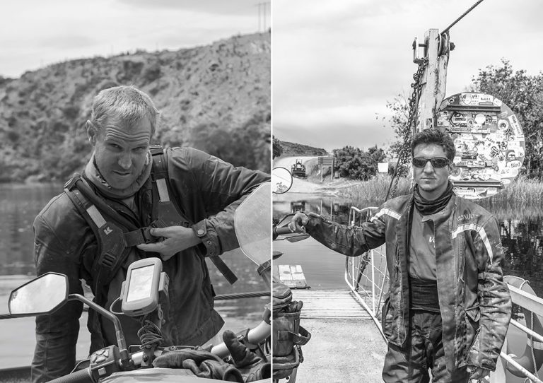
Chris (left) and Tyson (right) crossing the pontoon at Malgas.
The dirt started again southeast of Inverroche and I rode ahead to test a theory I’d been formulating since we left Cape Town: that the throttle of this motorcycle was directly connected to my face. Every time I twisted it, a smile broke out beneath my visor.
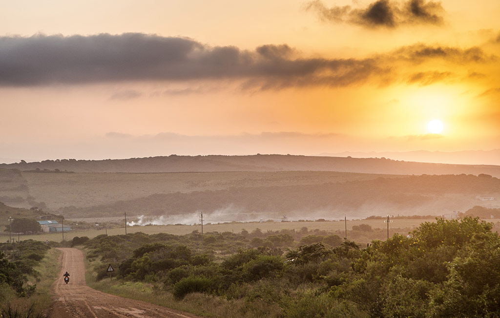
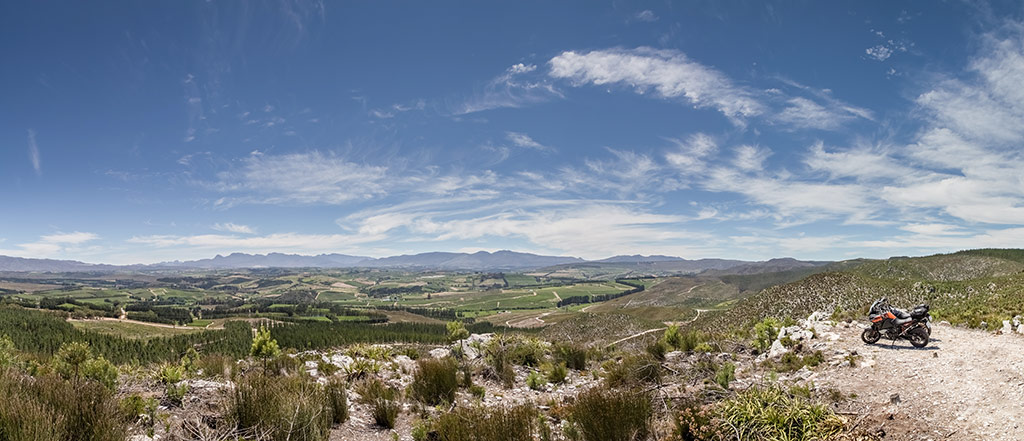
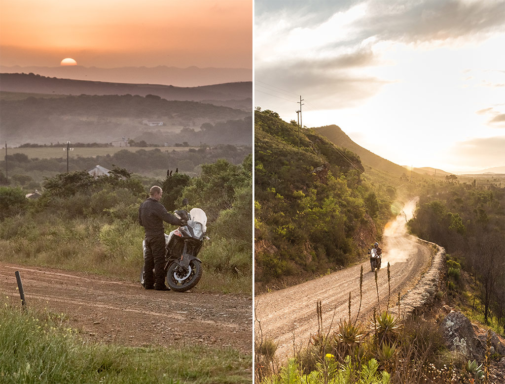
After 20 kilometres a splendid detour forked off to the right: a bumpy farm track, twisting through coastal scrub and forest for a heart-thumping 12 kilometres before re-joining the main track and, very sadly, the tar soon after. By now the sun was plummeting through the clouds towards the horizon like an egg yolk dripping down a kitchen wall, so we gunned it across the R325 and over the Gourits River to Boggomsbaai, where we’d booked a stay at Strandloper Cottage. As the sun disappeared, we discussed our ride. We’d both seen the same things, but what stuck out for each of us differed. That’s the magic of biking, and together we recalled a day’s riding that felt so much longer than sunrise to sunset.
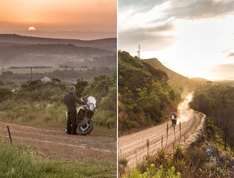
LEFT: Nearly home. A quick stop to check out the sunset, a few kilometres from Boggomsbaai; RIGHT The gravel road from Caledon to Greyton was so spectacular we went back to ride it again… and again.
The next day we had breakfast in Mossel Bay and headed back to Cape Town on the N2. It felt hard and unfriendly, and so very, very straight. Without it, of course, journeys would take days, but on that asphalt conveyor, the Overberg felt so far away. The patchwork fields stretched away from us, there was no dust, no gravel and everything smelled the same. White lines flashed their official directives below our dirty boots. Signs pointed south to the places we’d seen and I longed to turn at each of them. In Botrivier, we pulled in at a service station to refuel and the attendant asked if he could wash my screen. ‘No thanks,’ I said. I wasn’t ready to wipe the adventure clean. It’s a beautiful thing, to swap four wheels for two, tar for dirt, and re-imagine a way of travel that’s unsanitised, unpredictable and absolutely exhilarating.
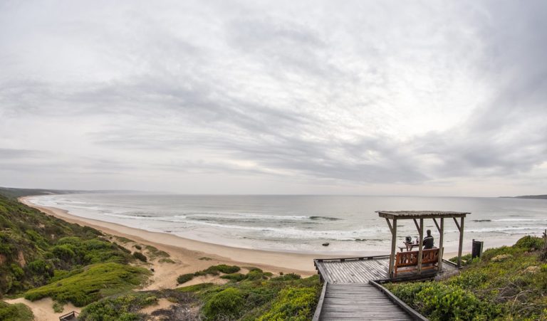
The beach at Boggomsbaai, our final overnight stop, was empty as far as we could see in either direction.
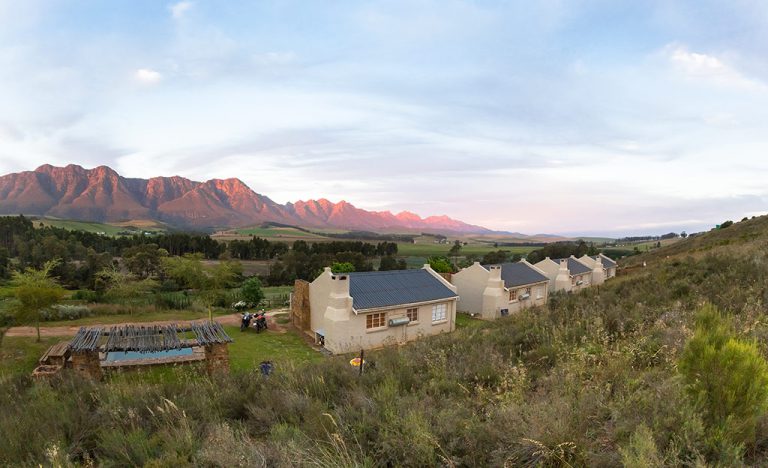
Oewerzicht’s Uitsig cottages, just outside of Greyton.
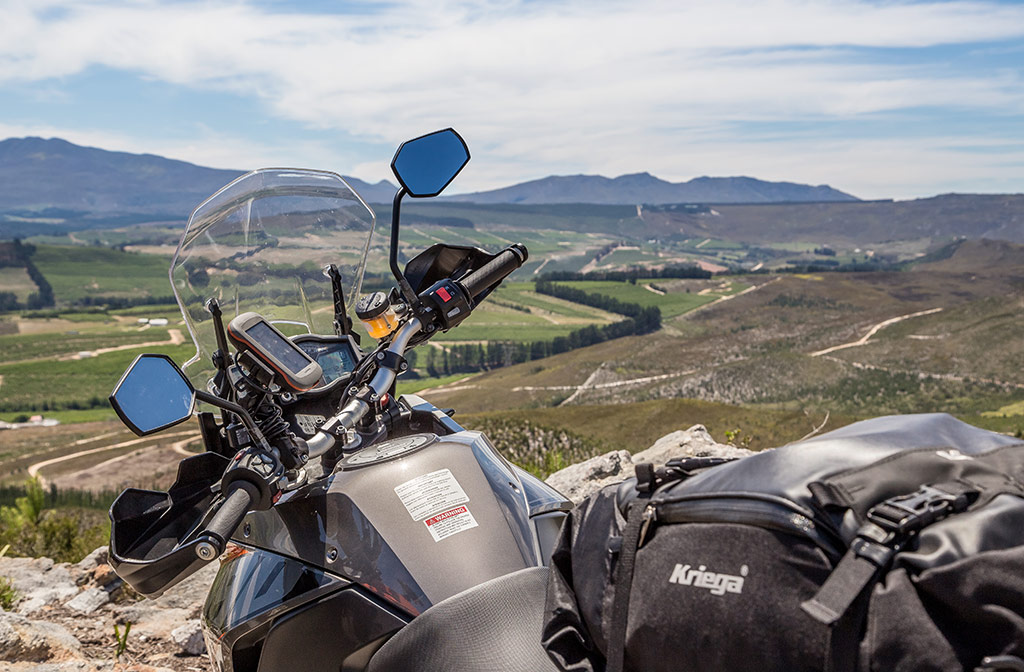
Our motorbikes
We borrowed an 1190 Adventure and 1050 Adventure from KTM Cape Town and promised to ride them gently, but then we forgot. Both models (even with standard road tyres) were incredibly responsive and stable, inspiring more confidence with every turn – it was impossible not to have a little fun.
The riding position, extra power (150 bhp versus the 1050’s 95 bhp) and off-road pedigree of the 1190 made it the immediate favourite and because I’m such a pushover I let Chris ride it most of the time. Both bikes have a 23-litre tank and we averaged between 5.8 and six litres per 100 kilometres (depending, of course, on how much fun we were having). Both models have ABS and traction control but the 1190 has electronic suspension and an off-road riding mode as standard. We both love our own adventure bikes but honestly (and I’d never say this in front of my KLR), it was hard to give those KTMs back.
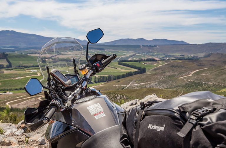
We couldn’t have done it without our Garmin Montana and Tracks4Africa combo, and Kriega US Drypack luggage.
Navigation
If you’re serious about exploring – and to my mind this is almost entirely the point of adventure motorcycling – you need a rugged, waterproof, shockproof GPS loaded with good tracking software. A Garmin Montana and Tracks4Africa combo is king. The Montana is glove-friendly, the display is bright and you can mount it vertically to avoid a cluttered cockpit. With Tracks4Africa there’s no voice prompt to tell you where to turn, but the road network is exhaustive and includes conditions, fuel stops and numerous points of interest. Familiarisation with the interface is vital – it’s not as intuitive as regular navigation software and you need to keep an eye on where you’re going. However, the ability to plot routes and distances and mark waypoints make it an adventure-biking essential. Garmin Montana 680. Tracks4Africa SD card.
For a more traditional motorcycle navigation set-up, the Garmin Zūmo 590LM is hardy, waterproof and has a left-hand- oriented mode as well as lane assist. The display is bright, has anti-vibration technology and can be operated with gloves. It also connects to a phone via Bluetooth. Garmin Zūmo.
Luggage
Motorcycle luggage is a polarising issue. Some say a hard-luggage system (top box and pannier cases) is best but for off-roading, but I’d go with soft luggage. It may not have the security but it’s a little more affordable, less likely to break if you fall and you can customise your carrying capacity. The Kriega US Drypack luggage series is a top option for this. There are four bags in the range: a five, 10, 20 and 30-litre. Each is fully waterproof and designed in such a way that they can be strapped together in various configurations. A single 30-litre bag is perfect for weekend rides, but I would recommend a 30-litre with two 20-litres strapped to each side for longer trips. ktmcapetown.co.za.
ALSO READ: A Suzuki Safari in the Northern Cape