






Strong winds of up to 80 km/h are expected along parts of the KwaZulu-Natal coast on Monday, 14 September, with eThekwini warning that beach activities, harbour operations and coastal navigation could be affected.
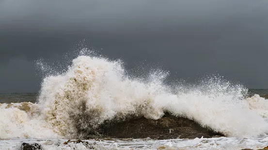
Against the background of a dark and dramatic stormy sky, big waves crash against the rocks in Boulder Bay, Ramsgate, KwaZulu-Natal/By: John McKeen/Getty Images
The South African Weather Service (SAWS) has issued a Yellow Level 2 warning for damaging winds, in effect from 8am until midnight on Monday.
According to IOL News, eThekwini Municipality said a strong high-pressure system is expected to bring northerly to north-easterly winds averaging 35 to 40 km/h, with gusts up to 80 km/h.
Ports and small harbours could be affected
The strongest impacts are expected along the coast and in maritime areas.
Port and small-harbour operations could face disruptions as difficult conditions make navigation more challenging. Small vessels may also be at increased risk of taking on water or capsizing.
Beachfront activities could also be affected, while strong winds may cause localised damage to structures, particularly in exposed areas and informal settlements.
The municipality has urged residents and visitors to remain alert as conditions develop.
ALSO READ:
Park Hyatt Johannesburg named Africa’s best new hotel for 2026
Beachgoers urged to take care
Anyone planning to spend time along the eThekwini coastline is advised to avoid high-risk shoreline activities and follow all maritime and safety warnings.
Residents have also been advised to secure loose outdoor items and exercise caution when outdoors.
Motorists should take extra care on exposed roads, particularly those travelling in high-sided vehicles, which can be more vulnerable to strong crosswinds.
The municipality said emergency response teams are on standby to clear fallen trees and debris, unblock stormwater infrastructure and assist communities if necessary.
Residents can contact the City’s Disaster Management Centre on 031 361 0000 in an emergency.
More severe weather expected across South Africa
The strong winds form part of a broader spell of unsettled weather expected across South Africa on Monday.
SAWS has issued several impact-based warnings, including a Yellow Level 4 warning for disruptive rain over parts of the Western and Northern Cape.
Heavy rain and thunderstorms are expected across parts of the western and central interior, while isolated showers are possible in parts of KwaZulu-Natal, Limpopo and Mpumalanga.
A Yellow Level 2 warning for severe thunderstorms is also in place over parts of the Northern and Western Cape, with the potential for localised flooding of roads, low-lying areas and bridges.
Along parts of the KwaZulu-Natal and Eastern Cape coastlines, damaging winds could affect small boats, vessels, harbours and beachfront activities.
Travellers and coastal visitors are advised to check the latest weather and municipal updates before heading out.
Follow us on social media for more travel news, inspiration, and guides. You can also tag us to be featured.
Instagram | Facebook | Twitter | Spotify
ALSO READ:
Nearly half of migratory bird species are in decline worldwide