South Africa’s rivers cross some of the country’s most varied landscapes. These six journeys reveal how the same waterway can shape agriculture, wildlife, food, communities and travel experiences as it moves downhill.
1. Berg River: from the Winelands to the West Coast
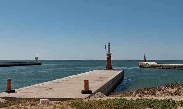
Velddrif, Laaiplek region, West Coast, South Africa, looking out to St Helena Bay and the Atlantic Ocean, where vessels leave the Berg River through the harbour. (Photo by: Peter Titmuss/UCG/Universal Images Group via Getty Images)
Start in the mountains around Franschhoek
The Berg River begins in the mountains around Franschhoek and flows for about 285km towards the West Coast. Its upper reaches are surrounded by mountain fynbos, while the river gradually moves into a landscape shaped by agriculture and settlement.
This is where the river’s role as a water source becomes particularly visible. Its catchment supports farming across parts of the Cape Winelands, with vineyards, orchards and other agricultural land replacing much of the natural vegetation at lower elevations.
Follow it towards the coast
From the Franschhoek area, the river passes through the wider Paarl and Wellington region before continuing north and west towards the lower Berg River. The scenery becomes increasingly open as the mountains give way to farmland and the flatter landscapes of the West Coast.
At Velddrif, the river becomes part of a very different world. River cruises, paddling, fishing and birdwatching offer ways to experience the water before it reaches the Atlantic.
The transformation: The river begins among mountain fynbos before passing through the Winelands, farmland and wetlands on its way to the West Coast.
2. Breede River: from mountain farms to Witsand
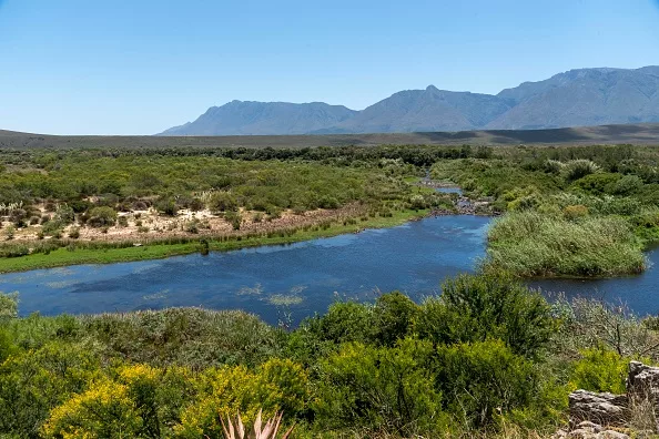
The Breede River viewed from Aloe Hill, Bontebok National Park. (Photo by: Peter Titmuss/Education Images/Universal Images Group via Getty Images)
Begin near Ceres
The Breede River rises in the Skurweberg Mountains near Ceres before travelling roughly 320km towards its Indian Ocean estuary. Along the way, numerous tributaries join it from the surrounding mountain ranges.
Its upper reaches are closely linked to agriculture. As the river moves through the Breede Valley, water supports vineyards, orchards and other farming activities around places such as Worcester and Robertson.
Watch the landscape change
The river then continues past Swellendam and through the lower Breede Valley, where its relationship with people and wildlife becomes increasingly intertwined. Bontebok National Park lies along the river, providing a chance to experience the waterway alongside indigenous vegetation and wildlife.
Near the coast, the river changes character again. Its estuary stretches towards Witsand, with tidal influence extending far inland. The permanently open estuary supports fish, waterbirds and several different plant communities.
At Witsand, you can finish the journey where the river meets the Indian Ocean, with activities including fishing, paddling and boating.
The transformation: From mountain headwaters, the Breede passes through vineyards, orchards and farming towns before becoming a tidal estuary at Witsand.
3. Tugela River: from the Drakensberg to the Indian Ocean
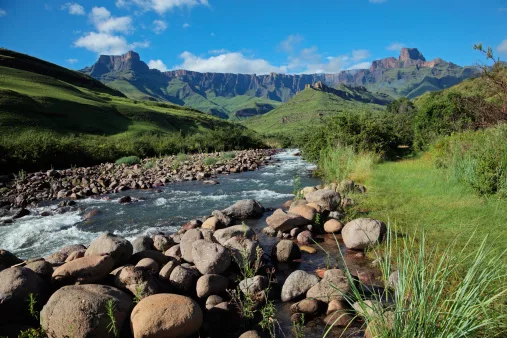
Amphitheatre and Tugela River, Drakensberg Mountains, Royal Natal National Park/By: EcoPic/iStock
Start high above KwaZulu-Natal
Few rivers offer such a dramatic beginning as the Tugela. It originates on the high Mont-aux-Sources plateau in the Drakensberg at around 3,050m above sea level. From there, the river descends through a large catchment before eventually reaching the Indian Ocean.
The upper reaches are dominated by dramatic mountain scenery, grasslands, cliffs and waterfalls. The famous Tugela Falls is part of this high-altitude landscape, making the headwaters one of the most spectacular places to begin following the river.
From mountains to the KwaZulu-Natal lowlands
As the Tugela loses altitude, the scenery changes from rugged Drakensberg terrain to rolling grasslands, farmland and settlements. Tributaries including the Little Tugela, Bushmans and Mooi rivers, add to the system along the way.
Eventually the river reaches its lower reaches and the Thukela Estuary before entering the Indian Ocean. The journey therefore links one of South Africa’s great mountain landscapes with the subtropical coastline of KwaZulu-Natal.
The transformation: The Tugela drops from high Drakensberg grasslands through valleys and farmland before reaching the KwaZulu-Natal coast.
ALSO READ:
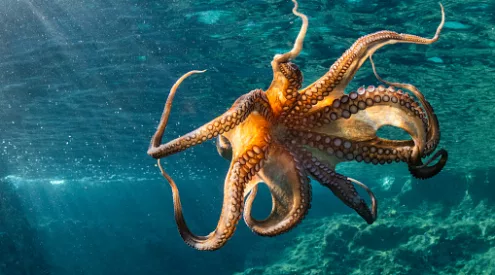
World Octopus Day: 8 fascinating facts about one of the ocean’s strangest creatures
4. Sabie River: from mountain escarpment to Kruger
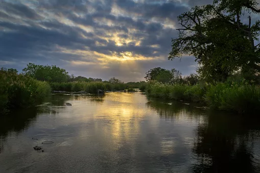
Lush riverine vegetation along the Sabie River with stormy clouds and sunrise, Kruger National Park, Mpumalanga/By: André Gilden/Getty Images
Begin on the Mpumalanga escarpment
The Sabie offers one of the clearest examples of how dramatically a river’s surroundings can change with altitude. Its source is around 2,130m above sea level on the Drakensberg Escarpment. From there, it drops into the Lowveld, with rainfall falling from around 2,000mm a year on the escarpment to roughly 600mm in the Lowveld.
That change in altitude and climate is reflected in the vegetation. The upper river passes through a greener mountain environment before becoming increasingly associated with the warmer, drier Lowveld.
Follow the river into wildlife country
The Sabie enters Kruger National Park and is joined by the Sand River. Here, water becomes a magnet for wildlife. Lower Sabie Rest Camp sits directly on the river, while the surrounding riverine vegetation supports a remarkable concentration of animals and birds.
The river continues eastwards towards Mozambique, making this a journey that does not end at a South African beach. Instead, it demonstrates how a South African river can cross an international landscape before eventually joining the Indian Ocean system.
The transformation: The Sabie moves from the mountain escarpment through forests and waterfalls into the Lowveld and wildlife-rich Kruger landscape.
5. Orange River: from the highlands to the Atlantic
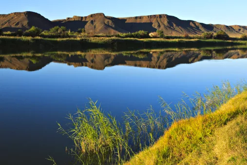
Gariep River, or Orange River, from Fiddlers Creek campsite. The river marks the border between South Africa and Namibia. The land across the river is Namibia/By: Kelly Cheng Travel Photography/Getty Images
Follow South Africa’s great inland river
The Orange is the biggest river in South Africa, but its journey begins outside the country’s borders. Known as the Senqu in the Lesotho Highlands, it rises at about 3,000m before entering South Africa and travelling westwards across the interior.
Its scale makes this one of the most extraordinary river journeys in the region. From the highlands, it passes through the Free State and Northern Cape as the surrounding landscape becomes progressively drier.
Watch the country become desert
The river eventually cuts through increasingly arid Karoo and Kalahari landscapes before forming part of the border between South Africa and Namibia. In the far northwest, the Orange becomes the lifeline of the |Ai-|Ais/Richtersveld landscape, where a permanent river winds through one of the country’s most spectacular desert environments.
The contrast is striking: snow and highland rainfall can feed a river that eventually flows through a landscape where water is exceptionally scarce.
At Alexander Bay, the Orange finally reaches the Atlantic Ocean.
The transformation: The Orange travels from highland country through the Free State and Karoo before carving through the desert landscapes of the Richtersveld and reaching the Atlantic.
6. Mzimvubu River: from the Drakensberg to the Wild Coast
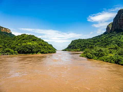
Mzimvubu River running between the mountains in Port St Johns/By: Arnold Petersen/
iStock
Start high in the Eastern Cape
The Mzimvubu begins at an altitude of roughly 2,700m on the Drakensberg escarpment. From there it travels for about 300km towards the Indian Ocean, passing through some of the Eastern Cape’s most rugged terrain.
Its major tributaries, including the Tsitsa, Tina, Kinira and Mzintlava rivers, also have their headwaters in the Drakensberg.
End where the river meets Pondoland
After descending from the escarpment, the Mzimvubu and its tributaries carve deep valleys through the coastal belt before reaching the sea at Port St Johns.
Port St Johns sits between mountains at the mouth of the river, surrounded by cliffs, subtropical vegetation and the landscapes of the Wild Coast. The area also offers river cruises, canoeing, birdwatching and marine experiences, giving visitors ways to experience the final stage of the river’s journey.
The transformation: The Mzimvubu descends from the Drakensberg through deep valleys and rural landscapes before reaching the subtropical Wild Coast at Port St Johns.
A river is a journey, not just a destination
Following a river from its headwaters to the sea reveals a side of South Africa that can be missed when destinations are viewed separately. A single waterway can connect mountains to farms, wildlife reserves to towns and dry inland landscapes to thriving estuaries.
The Berg moves from fynbos-covered mountains into the West Coast. The Breede becomes an agricultural lifeline before reaching a rich estuary. The Tugela drops dramatically from the Drakensberg to KwaZulu-Natal’s coast, while the Sabie carries mountain water into some of South Africa’s richest wildlife country.
Further west, the Orange crosses an extraordinary journey from highland country to desert and the Atlantic. In the Eastern Cape, the Mzimvubu links the Drakensberg with the rugged Wild Coast.
Together, they show that following a river can be one of the best ways to understand how South Africa’s landscapes, people and wildlife are connected.
Follow us on social media for more travel news, inspiration, and guides. You can also tag us to be featured.
Instagram | Facebook | Twitter | Spotify
ALSO READ:
6 South African coastal towns where the ocean is best experienced from land